
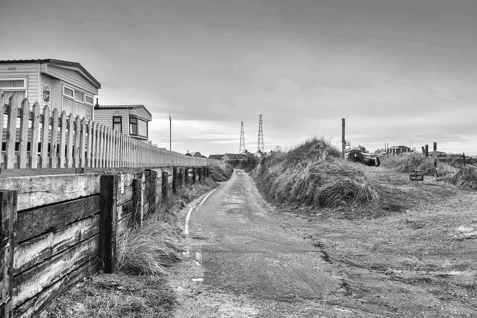
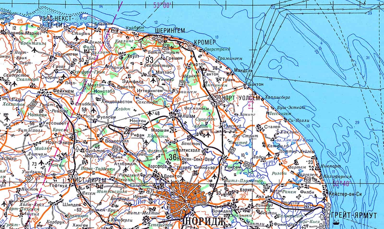
Bacton; a place name to conjure with if you know North East Norfolk’s emptier fringe. A confusing piece of coast where as you move north of Happisburgh; the cliff drops and as it swings further round and there is a vale where Walcott sits. A series of tiny villages have grown on the shallow plain before the mud, clay and sand cliffs start to rise and gain height towards Mundesley and Trimingham. Walcott marks the lowest point, the exposed concrete edge leading on past the Poacher’s Pocket where the Welcome to Bacton sign trumpets what is actually what remains of Keswick, a village largely long lost to the North Sea. What remains of it fades invisibly into Bromholm with its broken medieval priory and on to the fricative centre consonants of Bacton.
It’s an Anglo-Saxon place; Bacca’s tūn – the farmstead of Bacca – Old English – Anglian. This is what became Baketuna in Domesday and Bacton and Bacton Green today. The pattern of names around it fade in and out of temporal focus, more ~tuns like Paston. While Gimingham and Trimingham show their age with their ~ing~ marking earlier Anglo-Saxon incursions. Edingthorpe and Thorpe Market show the change in language as the Danes settled. And Trunch, a place which could point at something which predates the arrival of the Frieslanders, Angles, Saxons, Jutes and Danes, a name conjectured to be a possible rare survival from Norfolk’s Celtic past or maybe Norman French. And if it is the former Walcott could even be those Britons still living here in the shadow of the new lexicon crawling across the landscape erasing a different past we can’t know. There are three places called Bacton in Britain, Suffolk, Herefordshire and this one – ours. The village clings to the concrete, the gabions, and the wooden skeleton which snakes intermittently along the coast. The village fades as it sprawls like morse along the roads inland.
These villages names that conjure with memory. We didn’t come here often when I was a child, it had less parking than Walcott or Mundesley and sits in the shadow of caravan parks and Bacton Gas site, imposing it’s odd industrial ugliness from the shallow clifftop, looming up over the beach. I suspect it didn’t suit my mum’s pretensions. We came here to shrimp, my dad armed with a three foot wide net, a proper one. I had a flimsy toy bought from a bucket full of them in the local shop. His, a broom handle, mine a cane. They had a scooped edge to push over the sandy and shingle seabed, a loop of wire to hold the net open. You worked your way backwards and forwards looking for a shoal of little decapods scattering along the sea floor. He’d had some success before at Mundesley and further up on the North coast, taken home a couple of slopping buckets of full of these flicking almost transparent sea-lice, boiled them brown and pink in the seawater they travelled in. This time all we caught was toilet tissue and hard round turds. An old sewage outflow nearby which I think is still there albeit no longer used, I may be wrong. We recoiled from it, packed up the nets fast and that was my last shrimping trip here, probably in 1973.
Bacton Gas terminal was vital for the national energy infrastructure in 1970s and 1980s Britain, one of six terminals for our offshore gas. The tumbling expanse of pipes was commissioned in the late 1960s and started production in 1968. At its peak 12 million cubic metres of natural gas a day came through the 180 acre site, with its frontage of just over half a mile of cliff. The gas was piped off down the side of the old Beeching railway track bed to North Walsham. It is still in use today although gas North Sea gas has declined rapidly over the last thirty years.
It was a huge part of the local economy, a major part of the community. Along with Smedley, Crane Fruehauf and the small engineering and plastics companies which flowered between the walls of wheat and beet. Mums and dads of school friends and friends themselves worked either here or offshore on the gas platforms as part the industry. People appeared, coming here to work and in some cases vanishing again to Aberdeen, Peterhead or Humberside following the flow of specific jobs. The industry was a routine part of life in North East Norfolk, friends went straight from school out to the rigs, worked offshore, did diving and safety courses. Rig helicopters flying in and out were a feature of life traversing the skies above town taking staffers offshore and back home. There’s the noise of rotors over the beach today, triggering a memory that points me at just how much the industry is part of our lives out here. In 1981 a helicopter went down; Whisky India – a Westland Wessex 60 run by Bristol was transferring Amoco gas workers from the Leman field to Bacton dropped 1500 feet into the sea just of Happisburgh. The engine had failed. Life is unfair, not enough of the wreck has ever been recovered to complete a full investigation, such is the nature of the shifting sands that surround us. 13 men died, including the pilot and attendant, one of them was a schoolmate’s dad. The silence the next day at school was deafening.
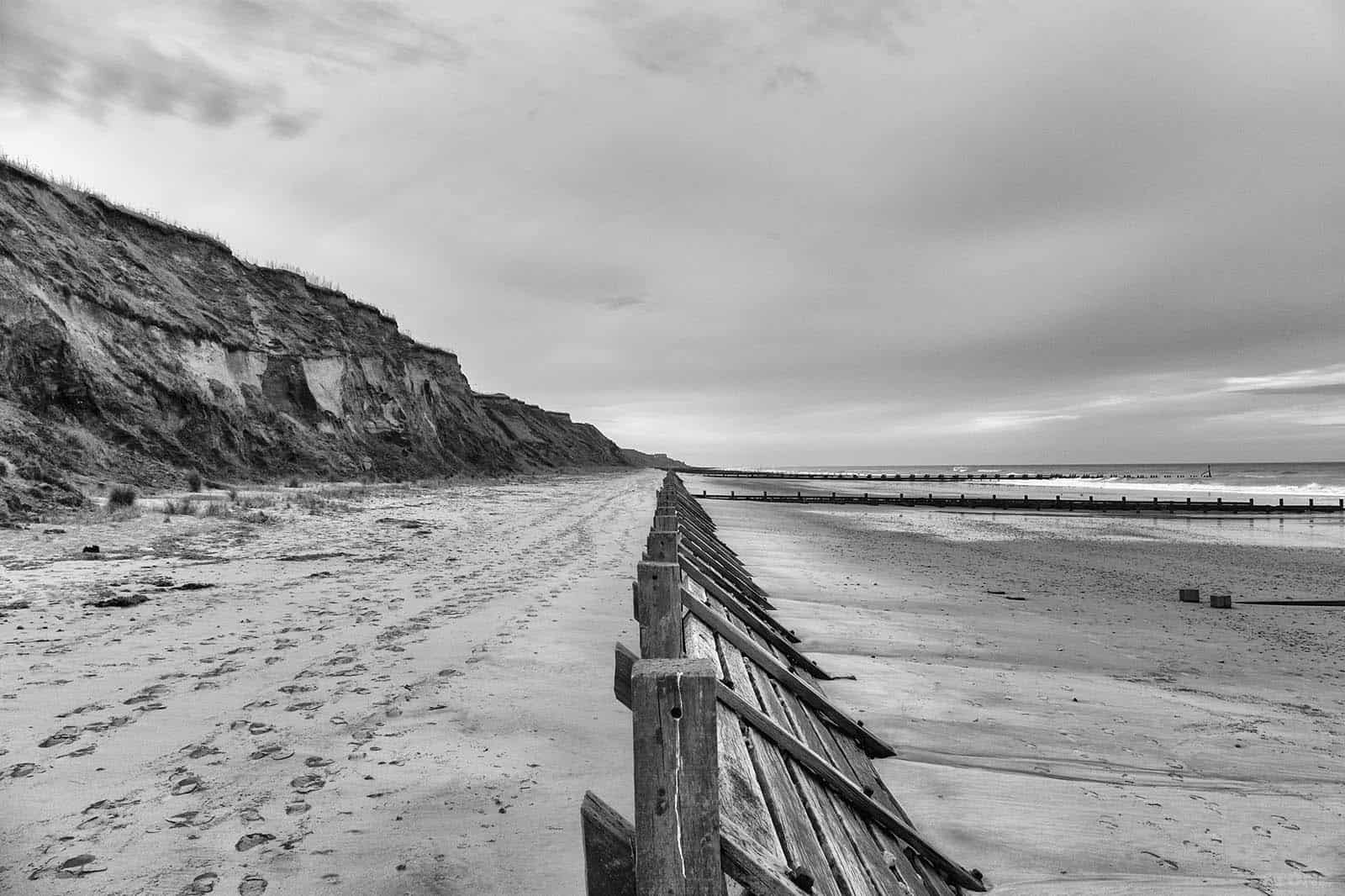
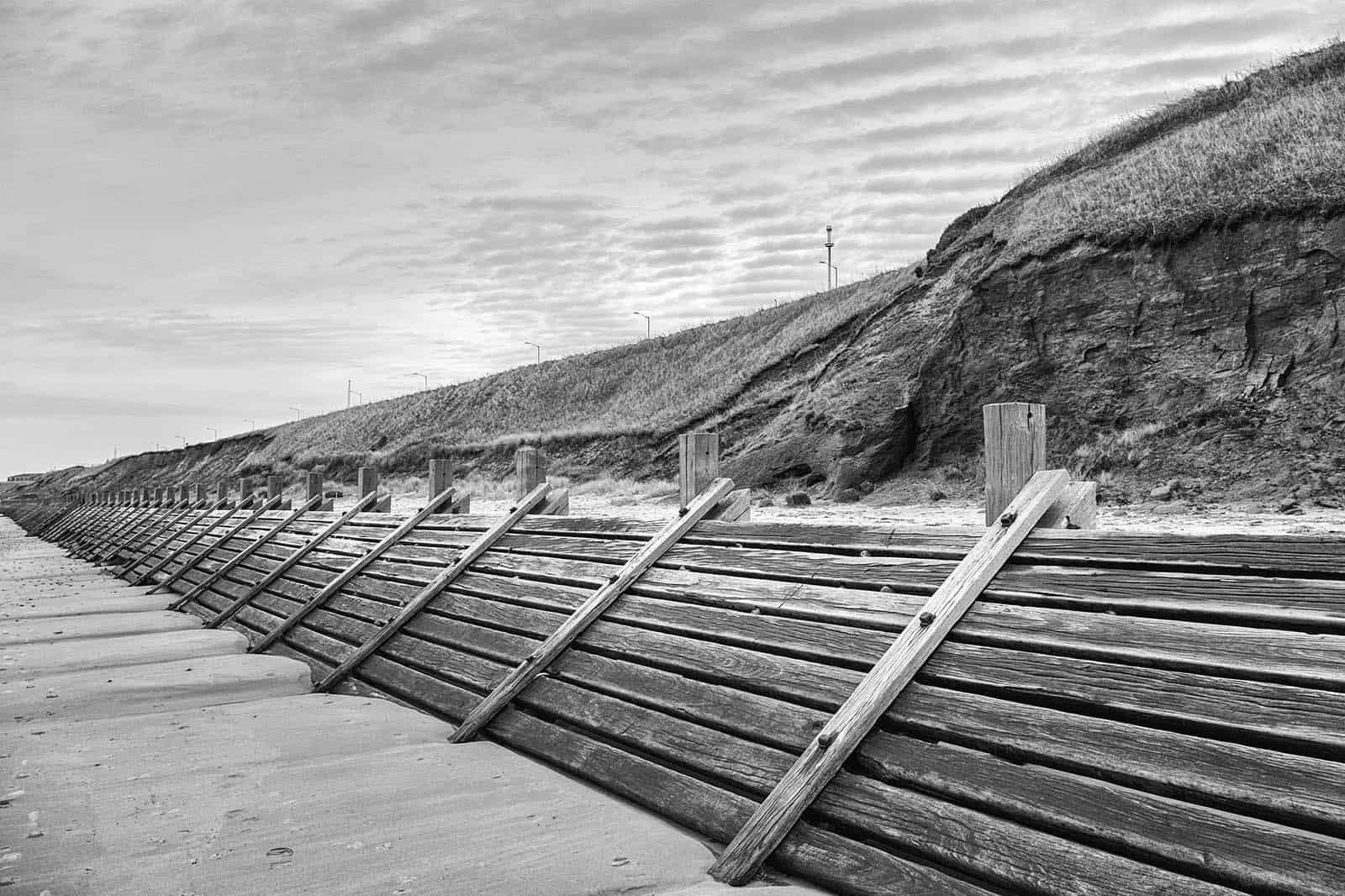
The beach is typical of this part of Norfolk. These are the edges of Doggerland, hacked off and bitten away by the sea. When the tide is out the beach is wide and sandy, scattered lines of pebbles. Above it soft cliffs of glacial mud, alluvium and clay slump in slow motion. The sequential deposition of these are visible if you look at the numerous water-bound cliff falls even for a few seconds. It’s one of those bits of landscape in section where you can walk backwards through a few thousand years using your fingertips, see the layering so pronounced in places. This clay moved in vast toes pushed by ice and then dumped it, all overlain by alluviums put down as the ice melted, sands and muds forming in pools on top.
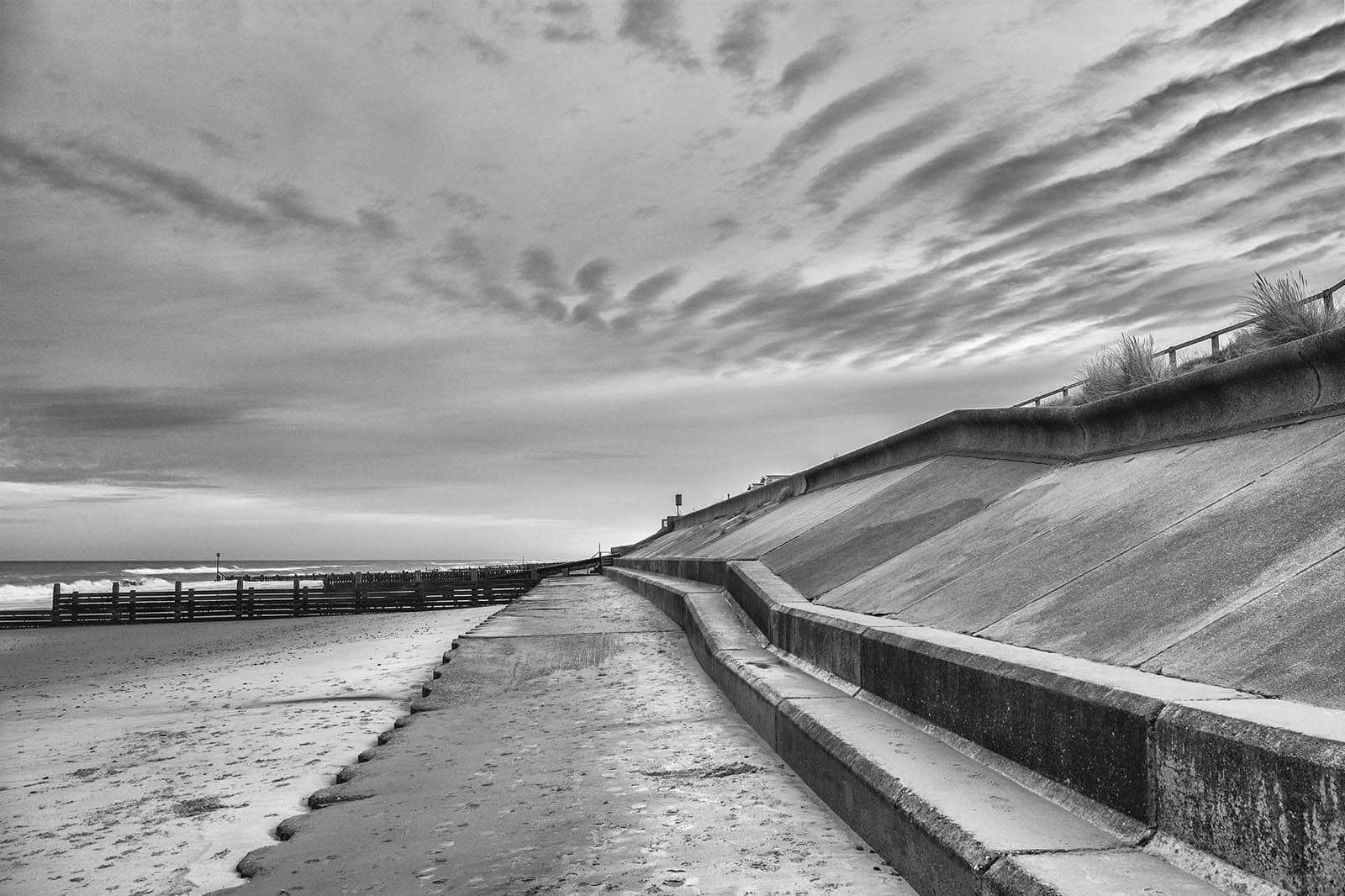
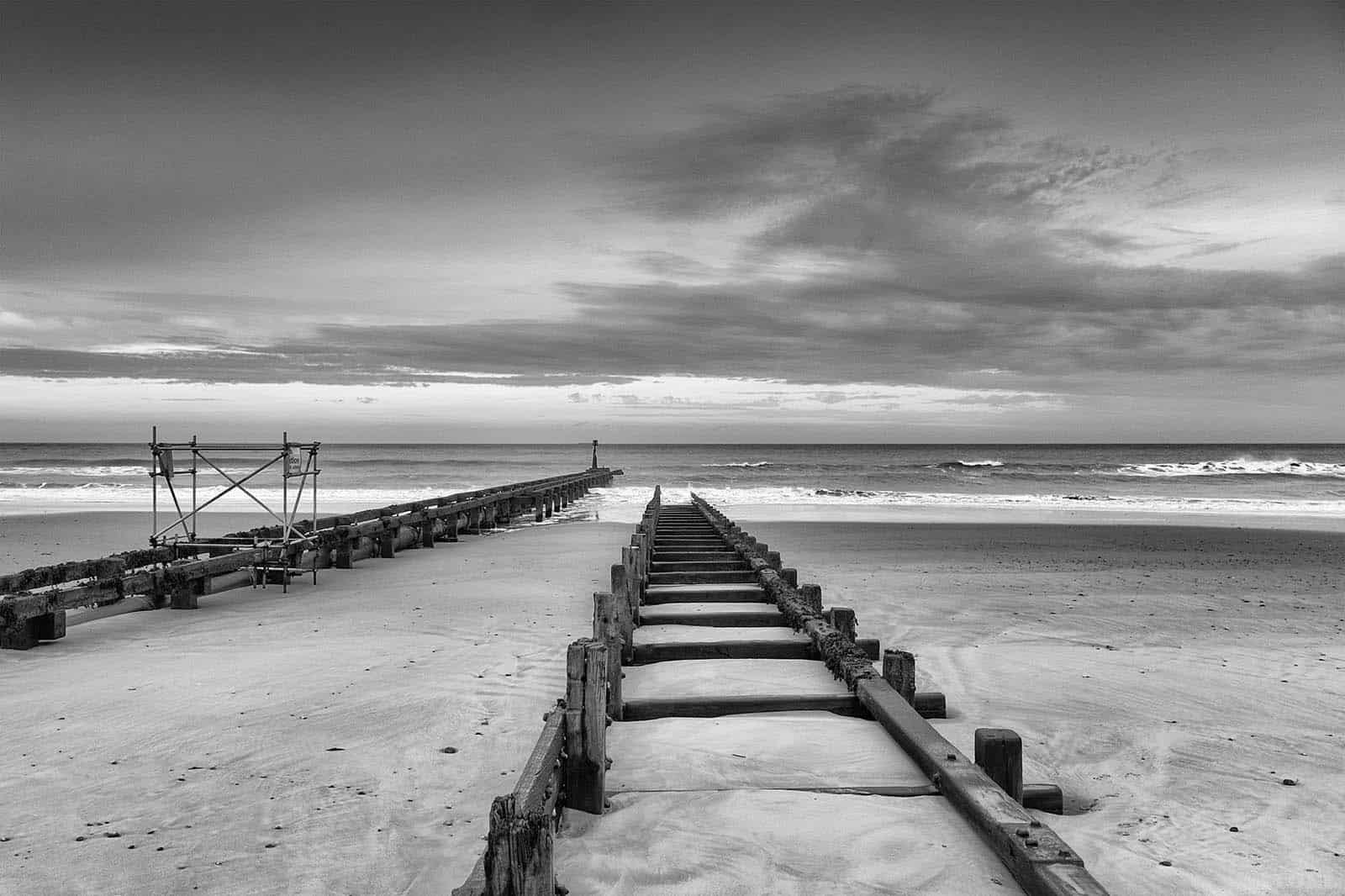
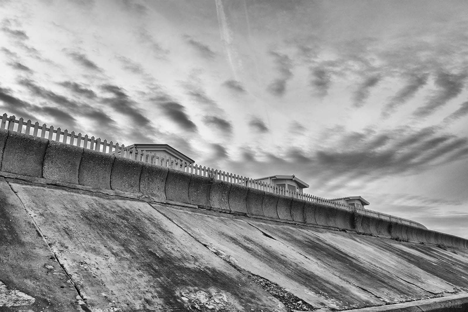
Unusually the sea defences are in good condition, the spine of wood runs the length of the gas site and is; unlike further down the coast around Happisburgh; largely intact. Currently new private defences are being laid here – fossil fuel suppliers protecting their best interests from erosion. The level of irony rises faster than the waters. Here, a fossil fuel distribution centre is protected from rising sea level and increasingly unpredictable weather patterns, caused by burning fossil fuels that are distributed from well, here. The sand is higher than I remember it against the defences as a child. Wrapped in towels, we’d lean against the wood and metal driven down into the sand. Now they are only just on the surface in places. It’s all part of the fight to try and counteract the chewing of our eastern edge. The bitten material is churned and then pulled away, sifted, then dumped back and further along the coast helping form Blakeney Point and Scolt Head Island. Over the centuries this sand has gradually choked the old rivers like the Glaven and Stiffkey that drain North, building the salt marshes we know so well, half-protected by their wall of sand and shingle. Now gabions grow out of the cliff base, they’ve brought in stone from elsewhere to fill them. Diggers in a Christmas idle huddle together on the access slope, cover sheets whipped by the wind.
The beach below the tipped spine of wood is wet, still pools forming and bleeding out as the tide ebbs. We walk behind the breakwater to save our feet. It’s gloomy in the winter light in this canyon between the wood and the low cliff. Taking photos here is a bit of a risk – the gas terminal is quite fiercely guarded; outward facing anti-intruder fences, wire, dogs and police. I’m suddenly conscious of cameras on poles that appear to turn and follow us as we walk, whether they have be tallied up with a number plate from a missed turn earlier is open to question. I’d love to get in there and have a proper look, all that metal and pipework to record – our future’s industrial fossilised fossil-powered past.
A friend worked here in the early nineties. At the time she was having a relationship with someone who had worked on the site and then gone abroad, he came over in a Dutch-plated car and visited the site just to see if it had changed from the outside, see how it balanced up with his memory. He drove the five miles back to her house. Later they were disturbed by a knock at the door, two policemen standing there having somehow traced the plate back via his company to her house, curious as to what he’d been doing. You have to watch yourself when you’re being watched yourself.
As part of our fossil fuel supply it is not just a threatening overwatch, it also perceives its own threats. In the 1970s and 1980s at the height of the mainland bombings by the IRA it would have been a prime target. On top of this there were locally frankly terrifying rumours and stories about what it represented in a Cold War context. As part of our energy infrastructure it would have been a prime target had anything ever turned hot. It would have been a blister as intense as the sun in minutes and it was only a few miles from where we lived. And when you consider it in that context it was just one point in a local long-list including the likes of Sizewell, Coltishall, Sculthorpe, Mildenhall, Lakenheath, and Neatishead in a county dotted by Thor missile sites and cruise missile silos on airbases. So many points of attack on infrastructure, energy, defence, intelligence, centres for population and ports. This all at a time when the stately drift of the Туполев Ту-95 just off the coast was a daily occurrence, these huge planes patrolled the edges of our exclusion zone, backwards and forwards constantly traversing out of sight over the curve of the horizon. And for us? Just the unfocused rumble and occasional distant silver glint of the Coltishall Lightnings heading out to shadow them on our side of that illusory line above the grey of the sea in the blue of the sky, way past our sandcastles, shrimp nets, egg and cress, and ice cream.
Thanks to Comrade Reg at Soviet Auto Luxury Tours for the map.
My link to Bacton? Coach & Taxi driving for Mike Ward (RIP) in Mundesley. Driving the school bus to take children home & bring them back the next day. Carting Amoco workers from their beds to North Denes for early flights offshore. Taking packets and parcels from Amoco’s part of the gas site to North Denes to be flown out to rigs. Driving a full sized coach around the site when the Duke of Edinburgh (pub) car park was being used as a satellite car park for Interconnecter workers.
The garden wall of a property opposite the Priory entrance (a former pub or hotle) was made up of bottles cemented together. I never captured that and the restoration (tricolation) of the building saw the wall taken down.
An outstanding piece of writing , thanks Nick, I am delighted I found your site today – having tried to do something like this (and failed) I do have some idea of how long it takes and how difficult it is to write for an unknown audience.
Really enjoyed this piece, thank you Nick. That pipeline going into the sea, so straight. I get delighted shivers when I think where the other end is.
Thank you Nick – as always.
Lived in Bacton for a few years a young child – 68-71- in the flint fronted vicarage (facade c1780, older stuff behind it). Apparently it was once home to composer and folk music collector E.J. Moeran (who wrote Stalham River and many other English tunes). At least his father was the vicar of Bacton at the turn of the century. But some reports suggest they lived in a house called Cliff Holm, which is now the site of a caravan park next to the gas terminal.
Either way, the vicarage, which I think is now a posh B&B, is still the home of my dreams (if you ever win big and want to buy me a present).
Spent many chilly summer days on the beach (the east wind is unforgiving) hiding behind our pop-up windbreaks bought from the local bucket and spade shop. Trying to eat ice-cream sandwiches (the ones you had to make with a clever flip of the wrist to get the ice-cream out of its wrapper and onto one of the two wafers) without getting too much sand in them. Also fought (and thrashed) some ‘yankee’ kid (whose dad was working at the terminal) for control of a splendid red and white polka dot shirt that had pride of place in the village school’s dressing up box.
I remember too the garden wall opposite the priory studded with bottles (see post above) – shame to hear it’s gone.