Someone asked if I’d done any Loos aerials, I hadn’t, it’s not an area I’m hugely familiar with, it does tend to get forgotten in between all the noise about the Battle of the Somme and The Ypres Salient. There’s plenty of front in between and some of it was very hard fought. The Arras and Loos sector in particular along with Vimy. There’s something quite haunting about the coalfields and the heaps in particular even when blamming past to the bits I know better on the Route Anglais, and some names that conjure things in the mind, the Hohenzollern Redoubt and places like Dud corner in particular, You can see the Double Crassier (Coal tips) from just south of Ypres at Kemmel on the ridge.
Anyway I’ve done a few from some aerials I’ve found.
These are to a certain extend created at the mercy of the originals, if something brilliant exists they’re quite easy, if road layouts move and cities or towns get built it can be rather harder. So a challenge in this case. enjoy.
Hohenzollern redoubt
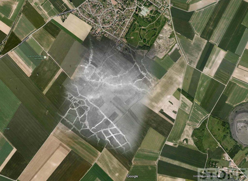
Hohenzollernwerk a German strongpoint near Auchy Le Mines. Photo 21st September 1915.
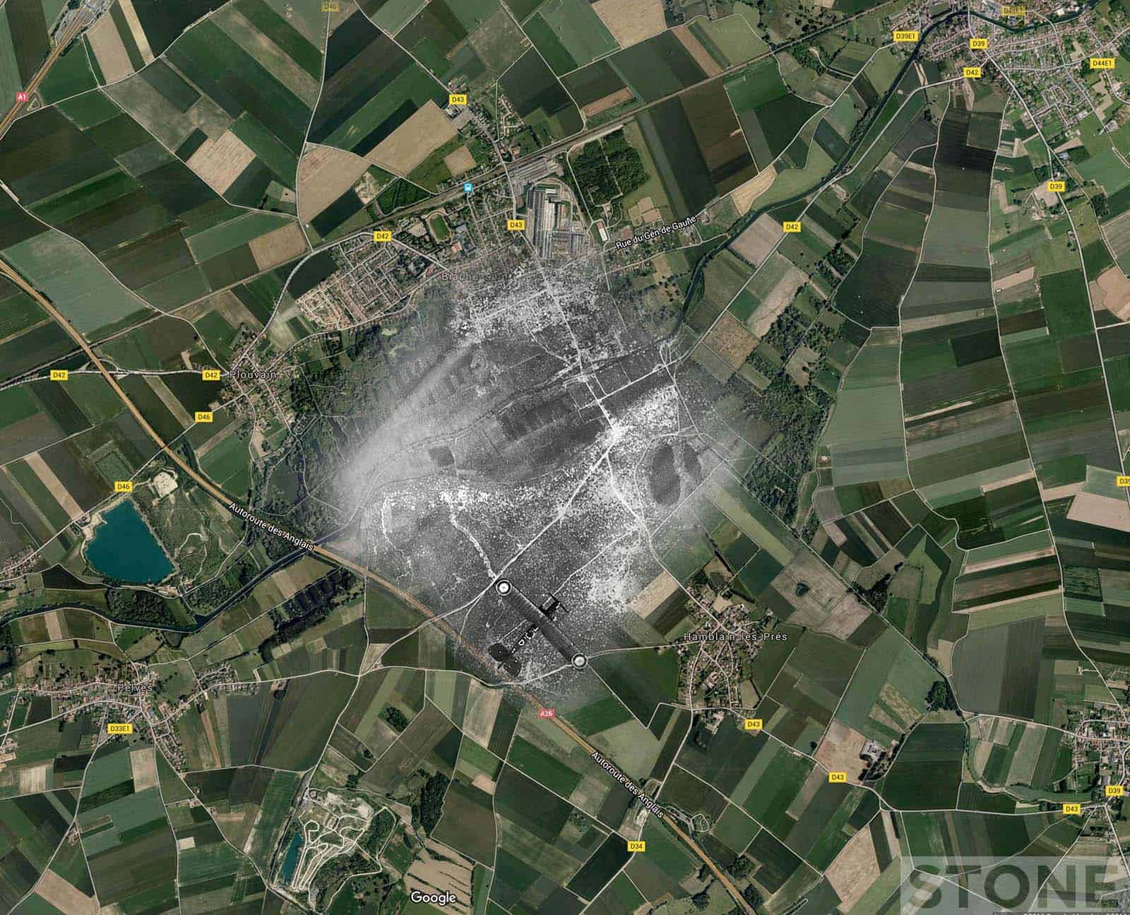
Airco DH.4 over Biache-Saint-Vaast

Circa 1917? (IWM)
Haisnes
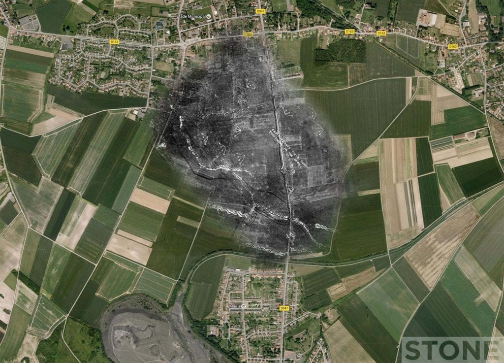
An annotated aerial reconnaissance showing German camouflaged field gun positions 23rd July 1918 (IWM)
Map credit Google.
Original photos Hohenzollern, CC out of copyright.
Bianche St Vaast and Haisnes – IWM.
combined images © Nick Stone 2016.