
Lyng Easthaugh
The lands to the west of Norwich have only a passing familiarity for me. I grew up in north-east Norfolk where I recognise the landscape facets and how they fit together pretty well, the marl pits and churches and the little winding roads that dip in and to of the countryside as it winds up through the tills towards the coast, how the waymarkers of church towers and masts fit together as you travel.
Lyng is a bit of a mystery. I know a few people in who grew up around Ringland, Whitwell, Lyng, Morton on the Hill and Lenwade, I fished a few bits of the Wensum years ago with maggots from vending machines on bits of common and on bridges, my family lived in Swanton Morley for a time in the late 1940s well before I arrived. Like most local people I’ve driven along the arteries and veins but rarely ventured down the capillaries. The A47, a slow pulsing stop-start run to the west on regular trips to Sheffield and the north over the years.
The A1067 is a different road, a meandering single carriageway where the cultivated scrubland of golf courses have sterilised the old agricultural land along the arterial routes that feed out of the comfortable middle-class suburbs of Taverham, Drayton, and Thorpe Marriott. It travels almost parallel to the Reepham Road which with this road separates this Dairylea slice of countryside from the pine woods, barrows and car yards of Felthorpe, Hainford and Hevingham just to the North.
It’s a route that goes back through clipboard-carrying primary school trips to Great Witchingham wildlife park and Castle Acre Priory. Hastily ordained picnics with friends on the slopes of the Bailey at North Elmham, sun-drunk under the spectral gaze of long-dead Saxon bishops. Like most we’ve been dragged from one hollow resin dinosaur to another by our children at the Dinosaur Park, bought a triceratops keyring and ice creams, had eardrums near split by the shrieking children on the adventure playground. In the early years of my job as a paste-up artist I was led to Cadder’s Hill – setting lists of races for Dennis Slaughter and Colin Armes, printing the listings for the scrambles and Eastern ACU, but that’s the extent of it, some focus points, but mainly passing through.
It’s very hot out here, the car readout informs me it’s hovering around 30 degrees, the air-con fighting a losing battle on the 25 minutes out of Norwich to Lyng. A turn-off past the mill-pool; human soup of reddening unsunned skin within, silent joy through a car window closed against the heat. With only one exception, these are the only people I see in the desertion of the backroads near the ~haugr around Lyng Easthaugh in the next two hours. I pull up into a rutted gateway where the road starts its steep rise onto the low scarp or haugh. Outside the fridge of the car the air is still a shock, the humidity now high, built under the cloud base of climbing, slow-boiling summer cumulus, my glasses haze as if I’d walking into a full pub on a cold night.
There’s a sign on the gate, Bull in field, he’s obviously occupied elsewhere doing what bulls do on hot days, the gate is held open by baler twine. Beyond the metal gate, a field full of cut hay crisps in the heat. I pick my way through, a short stroll down to a clump of trees. The flatland of the Wensum valley spreads out below the far boundary.
Hidden behind the trees, the remains of the chapel to St Edmund are remarkably unremarkable. Only one wall remnant visible, half a brick lined archway, possibly 15th century set in some older local flint, few clues remain as to the actual extent. Closer scrutiny reveals another flint corner buried in ivy and grass a few metres uphill.
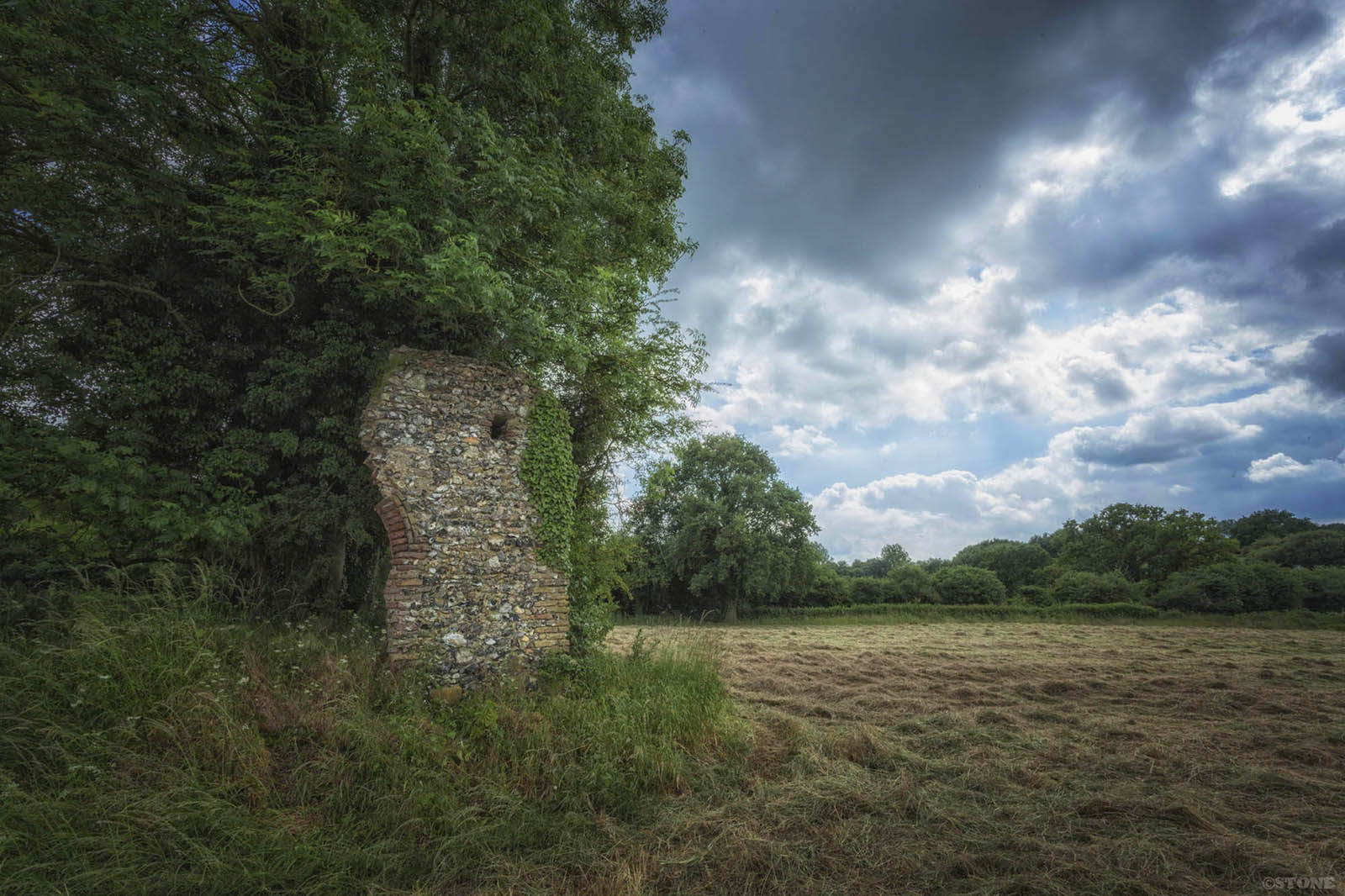
This is all the visible remains of a Benedictine Nunnery. It was set up in St Edmund’s name, presumably not long before one millennium folded into another. The vestige sits here to all intents lost in a field between Lyng and Lenwade where the land folds up above a river. There is no apparent reason other than he was the local Cyning, crowned in Burna which might be Bures in Suffolk in 855. What grew up around the later martyred king here in Norfolk and the myths around it are as far-reaching as they are confusing and convoluted. By the 12th century it was no longer a nunnery, the order moved to Thetford in 1174, the buildings gradually lost back to agriculture except the small towerless chapel with its dedication to St Edmund continuing its life as a church until it to started to vanish into the fields. The only link back was a fair in Lyng which continued to celebrate St Edmunds feast day well into the 18th century.
The cult extended across much of the land of the East Angles after his death and is reported from various later sources. Where he actually died is buried in folklore, and then wrapped in layer upon layer of complex hagiography. All records of his life and even his lineage destroyed by the Great Heathen Army as it advanced and then held East Anglia before instigating further attacks on Mercia.
A solitary man stands two fields away, watching me idly. I suspect I’m on his land, I pick up my pace and raise my camera as I head back up the slope, he lifts a hand and turns back to whatever he is doing as I reach the road just below where it cuts a gateway through the irregular block of trees that form the King’s Grove.
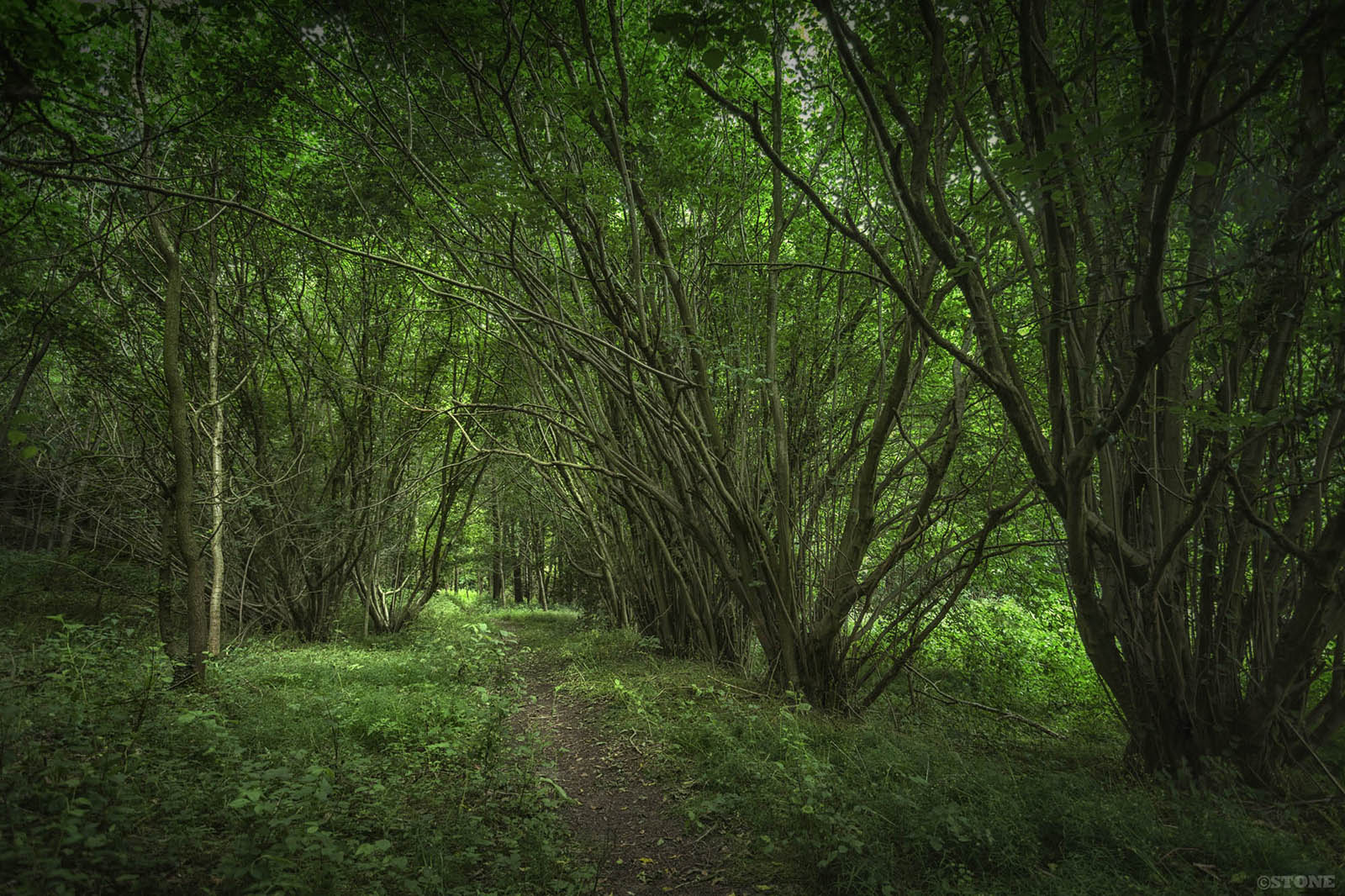
There’s a stile set back on the other side of the road. An ageing yellow NCC pathway arrow points into the rich green undersea light beneath the thickly veined leaf ceiling; beech, ash, oak, knotted together feeding themselves on the light. A few birch trunks like fluorescent tubes cutting through the green. To the east on my left is the rise of the scarp, it rises in low terraces under the trees. It feels vaguely reminiscent of a hill fort. Above me I can hear finches and sparrows, a startled male blackbird skitters out across the narrow path, heads up lost in the branches. This is used, dog-walked, but it still feels rare, it almost goes nowhere. The path is narrow, lightly trodden, the wear is thin. Dead and rotten branches and immature trees bow across it, thickets of nettles lean in, the remain of bluebells just visible now losing their identity in the expanding early summer thicket. The heated air hums with insect life, fizzing in the shade below the canopy, dipping down to prick skin and drink.
What is surprising is the definition of the hollow way which runs parallel to the west of the path; a near perfect survival believed to be pre-medieval. It’s route makes little sense, but here it is carved by feet, hooves, wheels and maybe maintained by a few serf’s hands. It rises up along the base of the scarp as a deep quite wide channel, trees and bushes break the line, but it is still nearly perfect. I step down into the bottom of the shallow channel and walk an unbroken stretch of it between sagging boughs, each footstep absorbing the heartbeat rush of age and time, carrying me under skeins of mistletoe, and barbs of holly, over the perfume of leaf mound and rotted roots, below the nettles, deep in the world.

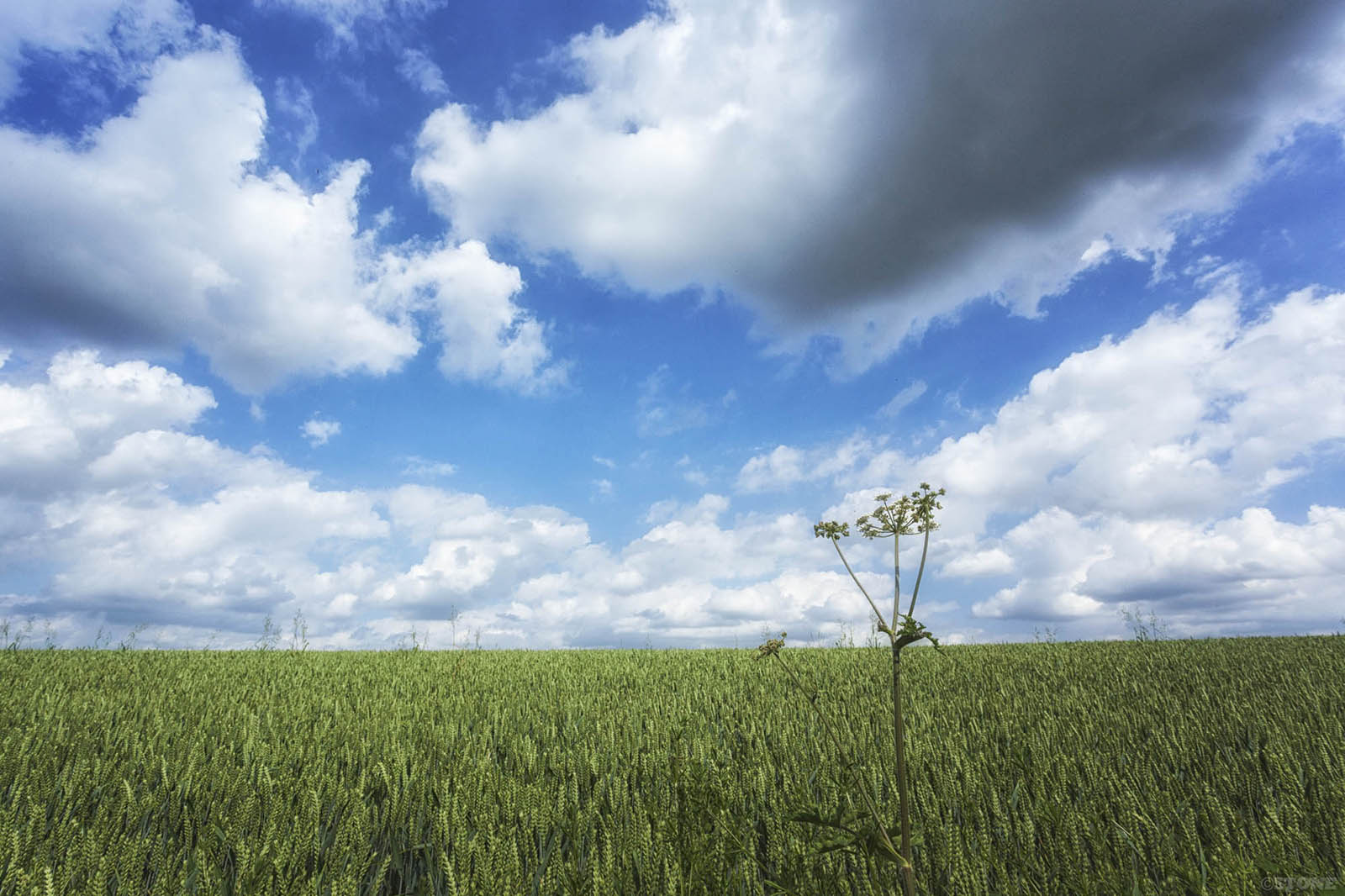
I break out at the top through tight brambles coming up for air on the edge of a field of wheat, the horizon rising to a flat calm. It’s mesmerising, the unshifting windless unripe green against the blue, the air singing with insects. I’ve got so intoxicated by it all I’ve forgotten to look for what I really came here to find. Maybe a third of the way back down it’s there; a piece of rock maybe a metre and half by 1 metre, jutting out of the ground. It would be at home elsewhere, here it is distinct. We don’t have rocks in Norfolk in this part of Norfolk – except these migrants. At best we have carstone in the west and here the flint bearing chalks hidden below glacial gravels. This big one is a sister of various glacial erratics that dot the ghost edges and moraines of the old ice sheets. Dumped here thousands of years ago as the ice retreated and melted. Despite one local farmer attempting to shift her with men and horses, she has sat exactly here ever since, gradually becoming welded into the landscape by the rhythmic leaf-fall of 12 thousand seasons as the planet does its racing circuits of the sun.
Erratics are strange things, a large percentage of them in our soft landscapes have strange mystical or ritualistic associations, everything from boundary stones to tales of witches, hauntings, meetings points and grave markers. This one is variously known as the Devil’s Stone, the King’s Stone, St Edmund’s Stone, and the Great stone of Lyng. It is linked inescapably into a hagiography some of which is still being created, surrounded as it is by St Edmund and the folk memories of whatever it was that did or didn’t happen here. Whether local folk tales have any basis in fact nobody will ever really know. Edmund has variously been alleged to have died near it, was found near it, or was buried near it at the chapel. It bleeds when pricked, the blood of whisperings of Pagan sacrifices, or else from the dead of the Anglo-Danish battle that took place from which King Edmund’s army may have retreated from here to Castle Acre. Birds don’t sing near it, although clearly they do I can hear them. It is haunted by the ghosts of nuns that walk down to the chapel across the road, there are ghost bells from the chapel and a chalice in the river, and the ghosts of horsemen and soldiers dazed from the battle in 869, so real was this story that in the mid 1800s schoolchildren were let out early so as not to have to walk past the spot in the twilight. And yes it probably is true – because these things can have their own truth inside people’s heads at least. There’s something about how these folk-tales pass along and lurk and grow in the undergrowth, how they adhere to place, make these things real in the subconscious, certainly more so in more god-fearing times.
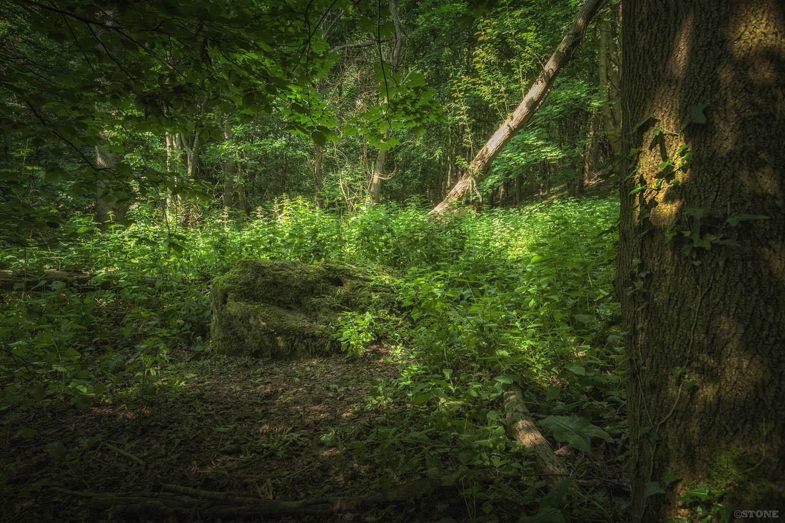
I stand here in the fuzz of the heat and midges and gnats feeding on me, nettles stinging through my trousers, and lay a hand on it, it is cool and damp, moss covered. There’s a conglomerate element, I think I detect some sedimentary characteristics lower down. There are scratch marks which could be striations from its journey on the ice or might not be, hollows in it, cut or otherwise. It looks variously like a frog or a giant horses skull. Obviously all this depends on the angle you view it from and who you are and what software you have pre-installed in your head. I’m not the first or the last, I am merely the most recent, or was. I would guess from the nettles trodden down, moss rubbed off, the last interest in it was a few days ago, weeks at most. Whatever way I try and view it, it feels uncanny and odd, a loaded lodestone, programmed as it with the weight of time and tales, in a place it shouldn’t be but for the power of nature pumping it along to this green resting point.
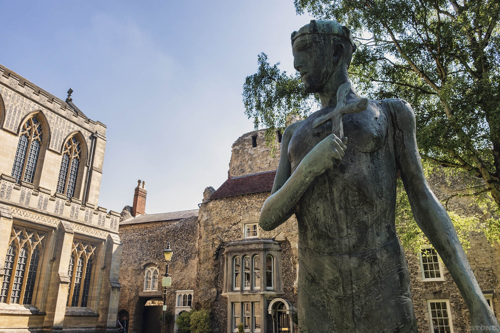
King Edmund died on the 20th November 869 at the hands of Ívarr hinn Beinlausi and his brother Ubba, the legends say they were particularly vicious and skilled Vikings who had led this particular episode of the attacks on the various elements of Anglo-Saxon Heptarchy. Folk tales and and later histories have it that when caught he was tortured, refused to renounce Christ, was tied to a tree and shot full of arrows. As a final indignity he was beheaded, his head cast into the thicket once the Vikingr got bored with their macabre game of catch. The head was retrieved later by searchers, found untouched by carrion, guarded by a solitary wolf. Handily he was still animated enough to call ‘Here! Here! Here!’. It is a martyr’s death by numbers.
This all happened at a place alleged to be called Haegelisdun. The lack of facts here is seriously confusing stuff, the air thicker with supposition than midges. It has been asserted variously that it may or may not be Hellesdon near Norwich, which certainly fits in terms of name etymology. The accepted line is it was probably Hoxne, or possibly Bradfield St Clare in Suffolk. Other sources suggest Maldon in Essex previously also known as Hailsdun. But if you read certain sources it might have been here and that’s why I’m here. Lyng and Easthaugh don’t fit unless you bring Hellesdon with it’s curious mix of houses and industrial units into it, sitting as it does just nine miles down the river – and then it’s still a stretch of the imagination. But sometimes when you’re on the spot it’s easy to fill that empty vessel. Haegelisdun, if Hellesdon is it, is in the midst of a concentration of church named for St Edmund. In a county with a spread of dedications, wall paintings, rood screens, and even an alleged landing point at Hunstanton. All of the religious art postdates Edmund by several centuries, but it does add to the overall impression of how strong the cult was in Norfolk.
Originally, before his veneration and removal to Beodericsworth or Bury St Edmunds, before the nunnery, King Edmund was apparently buried in a little wooden chapel in a field which curiously in this ebb and flow of the arteries and veins of the old routes and rivers may or may not be here. I walk back down to the road, it’s a slightly dislocating place this grove, but pretty. And here I am again, standing by a gate below a ridge, not far from a very old, slightly uncanny feeling alien rock, staring across at a chapel ruin. And that bull may be in the field or not, I can’t tell in this heat.

XXVIII
Processes of generation, deeds of settlement. The
urge to marry well; wit to invest in the proper-
ties of healing-springs. Our children and our
children’s children, o my masters.
Tracks of ancient occupation. Frail ironworks rust-
ing in the thorn-thicket. Hearthstones, charred
lullabies. A solitary axe-blow that is the echo
of a lost sound.
Tumult recedes as though into the long rain. Groves
of legendary holly; silverdark the ridge gleam.
Mercian Hymns – Geoffrey Hill
Links and sources
Read more on the St Edmund at Lyng theory on Joe Mason’s website.
Read more about the cult of St Edmund in East Anglia here.
Or read more stuff about exactly where St Edmund might be (including tennis courts) here on Francis Young’s website and buy his books.
John Copsey, ‘Lantern’ No.38.
Bruce Robinson & Edwin J. Rose: ‘Norfolk Origins 2: Roads & Tracks’ (Poppyland Publishing, 1983).
An Essay Towards A Topographical History of the County of Norfolk: Francis Blomefield.
there is a print available of the hollow way which is available in the shop here and one of the chapel here.
Fascinating, Nick!
Wonderful feature and photographs.
Thank you!
My grandparent lived in Lyng Easthaugh and I spent my holidays in the early 1940 and just before the war. My father Aubrey Wicks served his blacksmith apprenticeship with the Barretts of Lyng.
I plan to return for a nostalgic trip to Lyng. Lenwade and Ringland where I had/have relatives and so many happy memories.
I like how your writing teeters on the edge of the mystery although it is frustrating that you will not allow yourself to fall. Us modern people; our spirits are mostly crippled by this “age of reason” but we feel something beneath what our time allows us to see.
After longships we’re seen traveling up river aiming to sack the Anglo Saxon cathedral at North Elmham
A force was sent to intercept this Viking force . They marched along an ancient track linking Ringland , just outside Norwich ( where there was a watch station looking over the river wensum from Ringland Hill . )
This Saxon Army was spotted by a Viking patrol. The patrol reported back to the main Viking force ; they then set up an ambush ( a know Viking tactic ) using the contours of “ the kings Grove “ to trap and slaughter the Saxon Army . King Edmund being captured in the process .
As a ps
Recent metal detectors around nearby Nunnery have found no tale tale evidence of battle being fought around area of nunnery ( small buckles and metal finds ) therefore battle was fought up and around the Grove .