
Georeferencing
Playing with information, images and maps
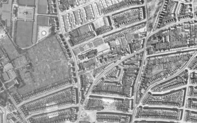
The Norwich Bomb map – Digitised
The Norwich bomb map was originally created by Norwich Air Raid Precautions Department to record all known bombs* dropped on Norwich between 1940 and 1945, including the extensive Baedeker Raids of 1942, giving the location, date of the raid and the type of ordinance...
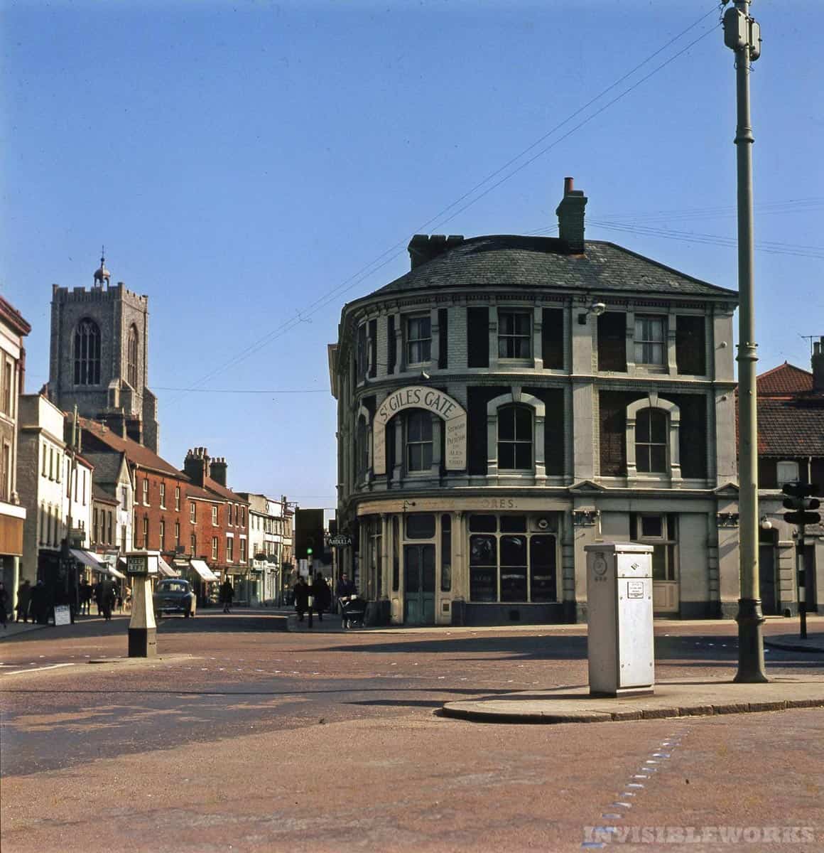
Norwich, a history in pubs
This is the work of Fraser White. In 2018 he created this using Google Maps to list all the pubs in Norwich possible, that includes closed ones as listed on the Norfolk Pubs Website and elsewhere. This is the kind of project I can get behind, so that's why it's here,...
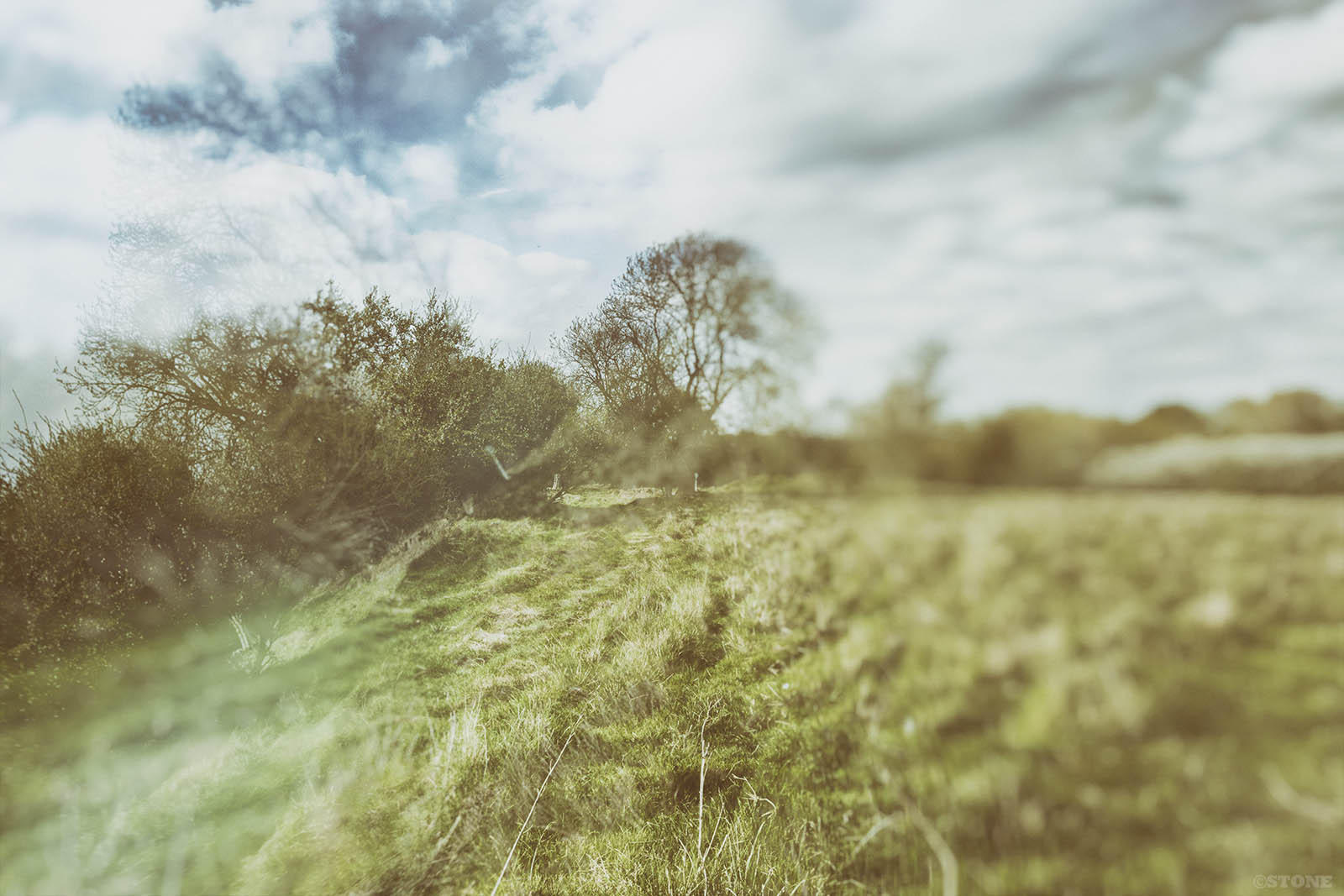
Geomapping: Norfolk’s Deserted Medieval Villages
A good few years ago Cameron Self and I were discussing DMVs or Deserted medieval Villages on Flickr, we'd both visited a few to take photos, thus began an obsession with them, not just the Medieval ones, actually all of them. There's an oddly romantic notion about...
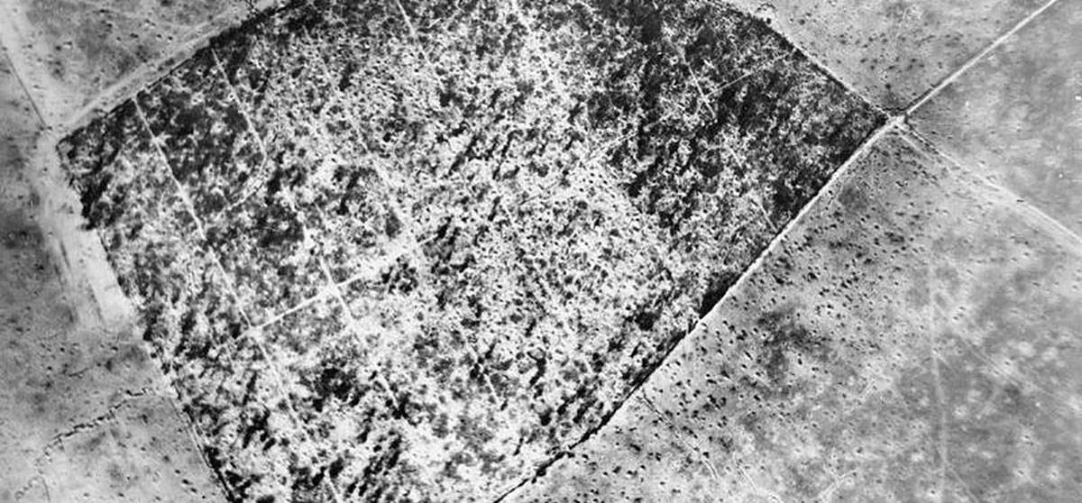
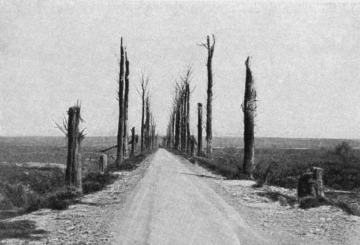
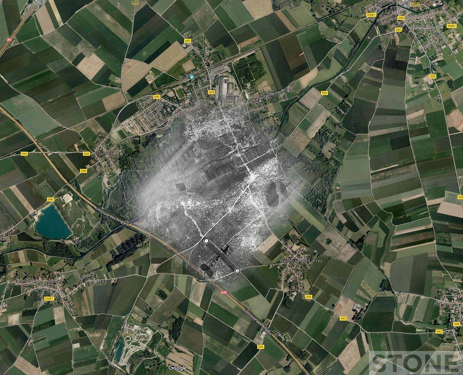
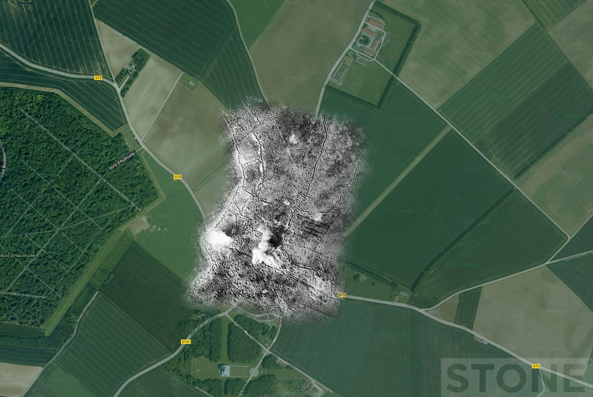
Trench Ghosts part 5 – The Somme – High Wood and Courcelette
A couple of ones that nearly got away, I forgot I'd done the High Wood one until a few minutes ago when someone asked so this makes sense. The Courcelette one is appropriate for today (15th September 1916/2016) High Wood © Nick Stone 2016 IWM/Google, High Wood...
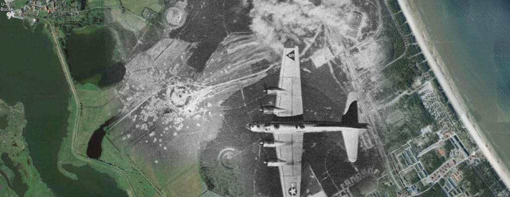
V2 aerial ghosts
Vergeltungswaffe 2 or V2, The Retribution Weapon. A less than charming name for nasty things. The Germans were way ahead of us with rocket and jet technology, in fact they were way just ahead of us with most technology for most of the war. I remember marvelling at the...

Trench Ghosts part 4
Langemark A few trench ghosts I did last week then got distracted and forgot about. One of Langemark and one of the Sugarloaf salient at Fromelles. The Langemark rephoto leaps out straight away. It's also familiar to anyone that's ever visited the German cemetery...
Aerial ghosts: Messines updated
I had a very interesting email today from Gil Bossuyt of frontaaltours.com which has prompted this post. Gil has been looking at the image I originally colourised in this piece. It goes thus: "I went searching on trench maps to recognize some road structures, and...
WW1: Aerial Trench Ghosts Part 3 – Lens
Someone asked if I'd done any Loos aerials, I hadn't, it's not an area I'm hugely familiar with, it does tend to get forgotten in between all the noise about the Battle of the Somme and The Ypres Salient. There's plenty of front in between and some of it was very hard...
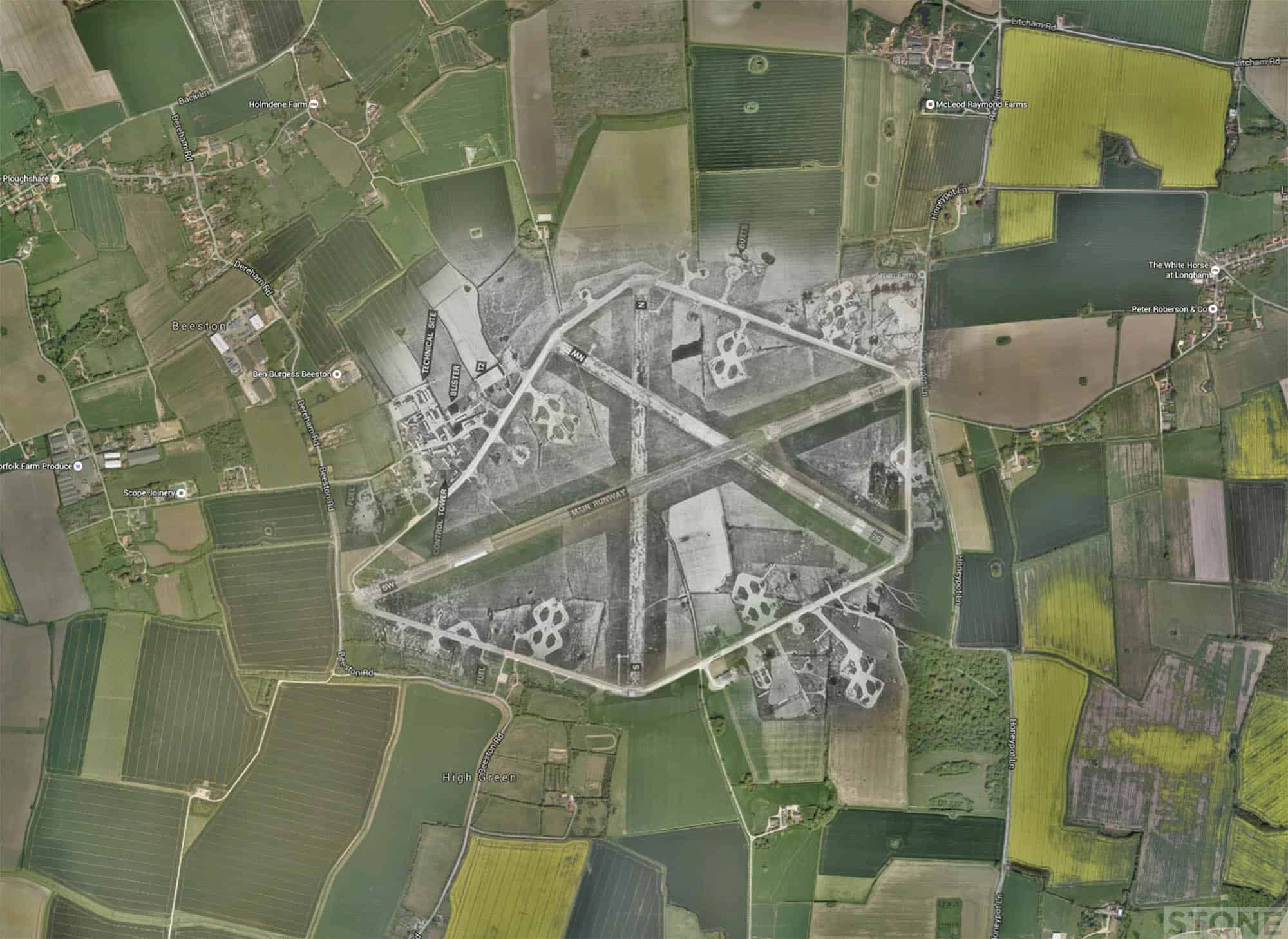
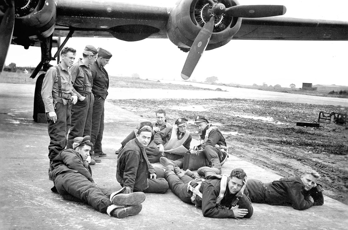
Ghost Airfields of WW2: Part 4
It's raining and blowy, what better weather on a bank holiday for getting the scissors and glue out and sticking things together. So here's a few more; RAF Old Buckenham, RAF North Pickenham and RAF Wendling. It's all good fun this isn't it, beats getting muddy. Well...
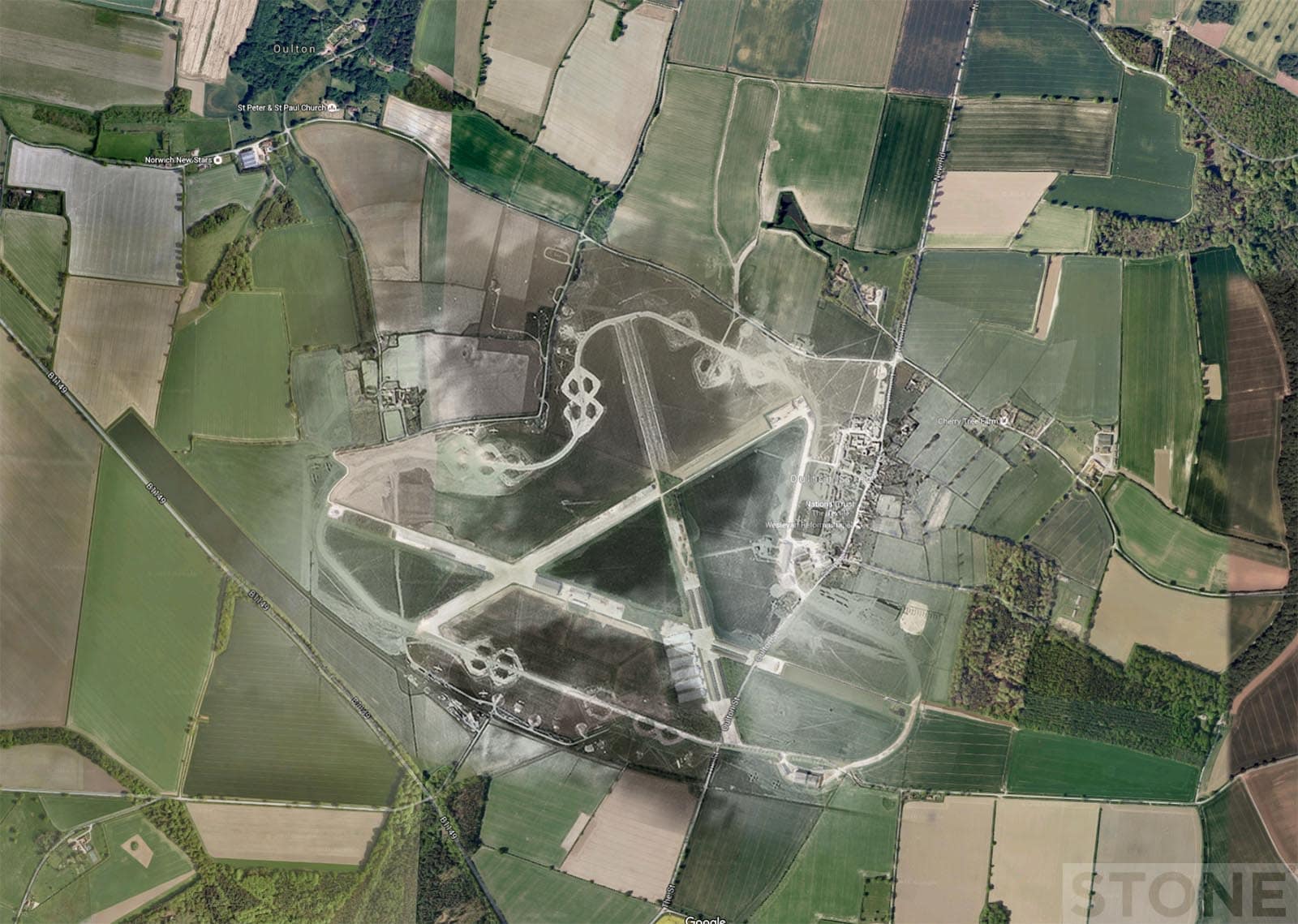
Ghost Airfields of WW2: Part 3
Ghost Airfields of WW2 We drove around RAF Oulton today on our way away from the huge pile of humanity trying to take dogs, bikes, jetpacks and assorted noise with them to Blickling Hall. We went to Heydon, because a lot of people don't and we wanted to restfully drag...
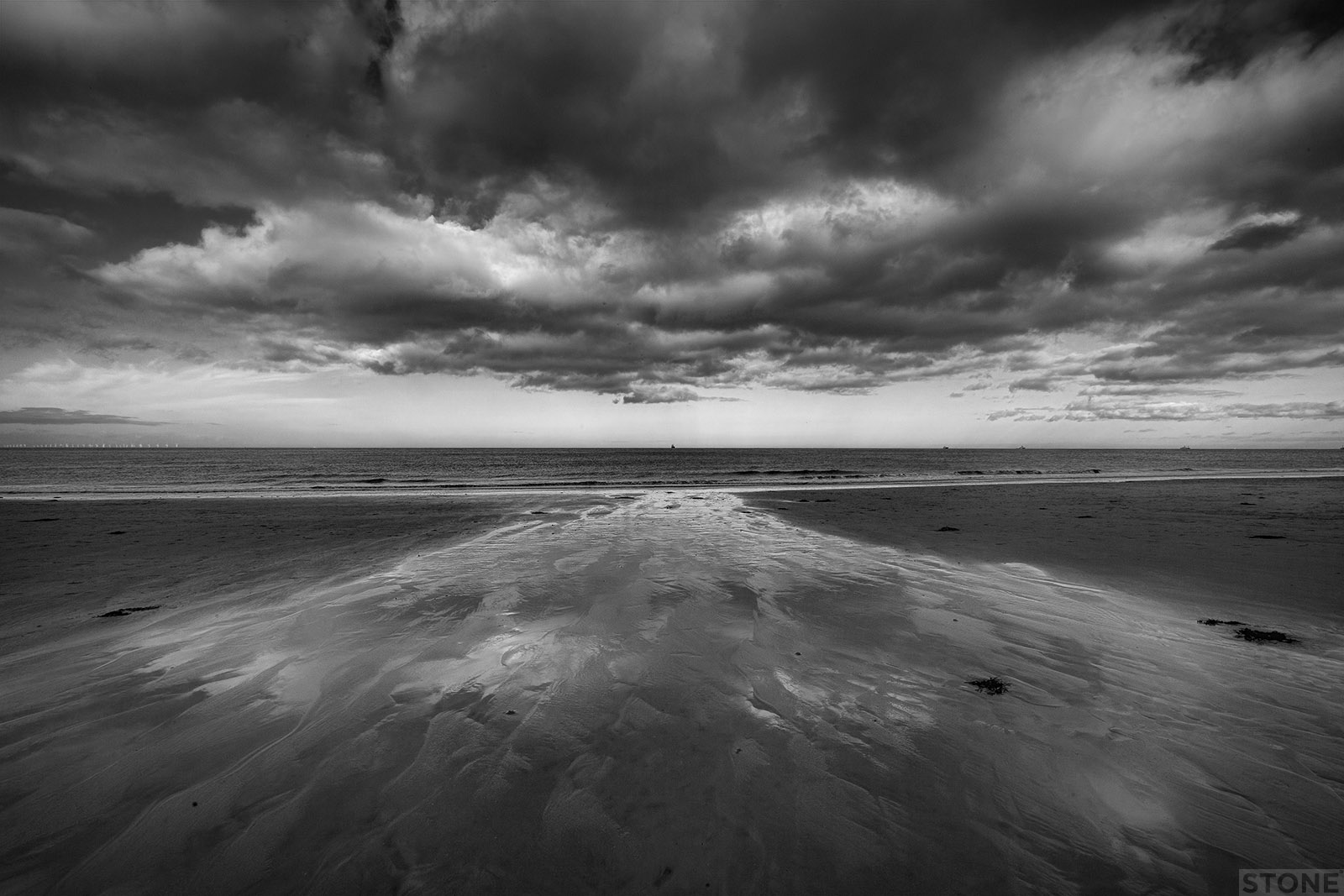
No place like home: Viking Norfolk
The landscape reveals many things about our past. You can stand in the middle of the city entirely enveloped in the past; the Norman cathedral and Castle, medieval churches and Tudor buildings, the remnants of war and peace, people remembered in plaques. To cast a net...
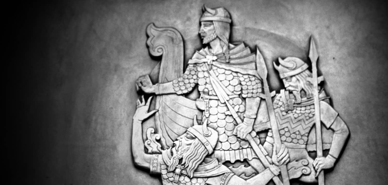
Norwich: “Brightest shining of the city”
Viking and Anglo-Saxon Norwich We live here. It is easy to forget where Norwich comes from, we take our surroundings for granted; a city that has grown from virtually nothing over the last 1200 years. A scattering of people living on gravel terraces above a bend in a...
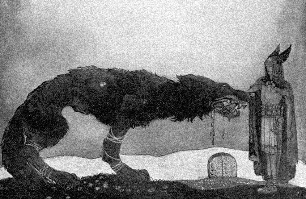
Mapping the Grim
This project on Black Shuck was part of the original intent of the Public Archaeology project (for PA2015) and for me, because data is poetry and maps are fine prose. Due to the nature of my working life; the fact that I'm a bit of a butterfly/battering ram when it...
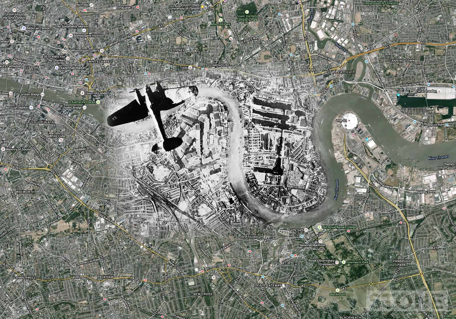
Ghosts: London blitz aerial maps
These are blitz ghosts: London blitz aerial maps using images from various collection overlain on Google map aerials. An iconic image from one German Heinkel III bomber showing another over Rotherhithe, the Surrey Commercial and West India Docks and Isle of Dogs to...
Maps: Norwich City Wall
Basically Norwich City Wall with all the main elements marked on, This is not 100% accurate for detail, It's stepping off point and that is all at that stage. Building started on 1294, finished in 1350-ish, then we started to pull it down. Privately financed partly by...
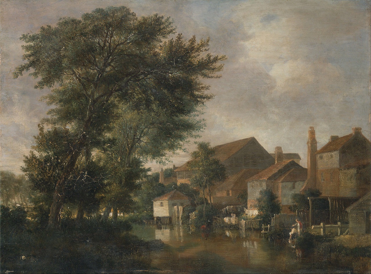
Lost Rivers of Norwich
I'm nothing if not unoriginal, this has come about for two reasons; me watching the excellent Thames Discovery project at work on Twitter, And more recently an idea of Jon Welch's based on seeing this rather remarkable work of Art by Stephen Water; his is hours of...
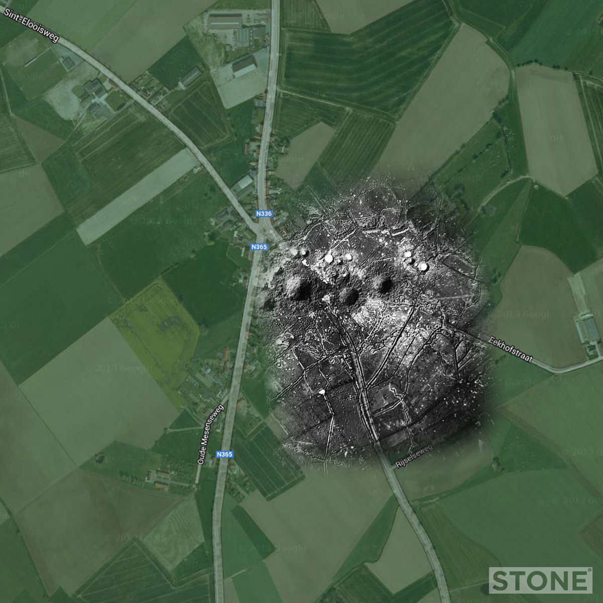
WW1: Trench Ghosts Part 2
Part 2 in a series of an uncertain number of these things. There's no project like an open ended one... St Eloi 1915 St Eloi is just to the South East of Ypres on the Salient, not that far from Hellfire Corner, or Hellfire Roundabout as it is now. There are a number...
WW2 RAF and USAAF airfields in Norfolk mapped
Several years ago, I did this entirely to satisfy my own wanderings around WW2 RAF and USAAF airfields in Norfolk. It's publicly visible on Google already, but it made sense to post it on the website to so it's more findable. It is worth noting that a lot of these...
WW1: Aerial Trench Ghosts Part 1
I did one of these to explain something to someone, then tweeted it and it all went a bit nuts, so it makes sense to put some of them together into posts on here rather than having them scattered to the 00000100 corners of the digital world. Schwaben Redoubt Early...
Ghost Airfields of WW2: Part 2
Second in the series, again a simple trick, sticking an aerial photo on a Google map, Maps eh, what's not to like. A selection here from the fair scatter across Norfolk, more to follow eventually. The Ghost above is from a series of photos which were pointed out to me...
Ghost Airfields of WW2: Part 1
I did these a few years ago, basically sticking aerial photos onto Google maps, I'd pretty much forgotten them until earlier. They seem worthy of a few posts. There are hundreds of these sites in East Anglia, and all, where accessible are worth a visit. If you want to...
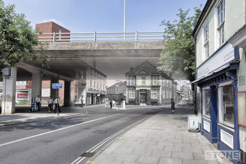
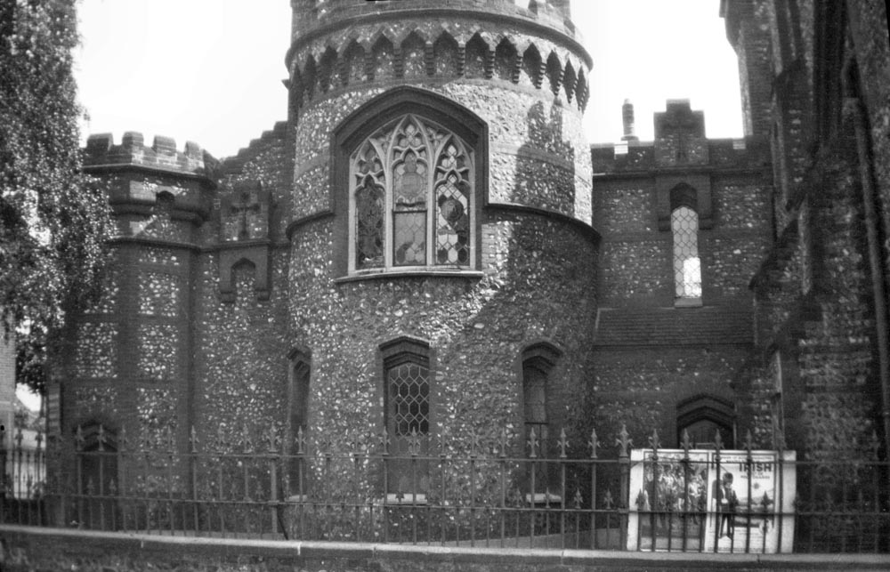
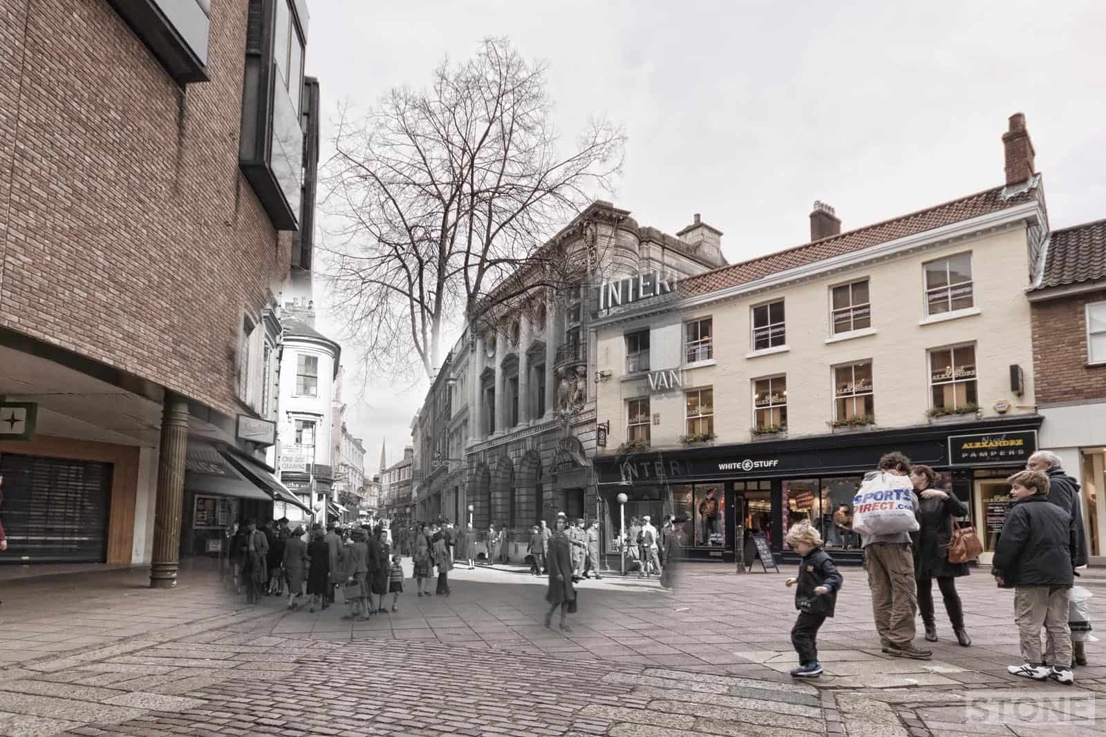
Magdalen Street: Part 1 – Introduction
Norwich-over-the-water is a strange place. Magdalen Street or Fybriggate as it was originally called and its immediate environs sometimes seem divorced from the city and historically were separated from the rest of the Central norwich by a relatively thin stretch of...