Langemark
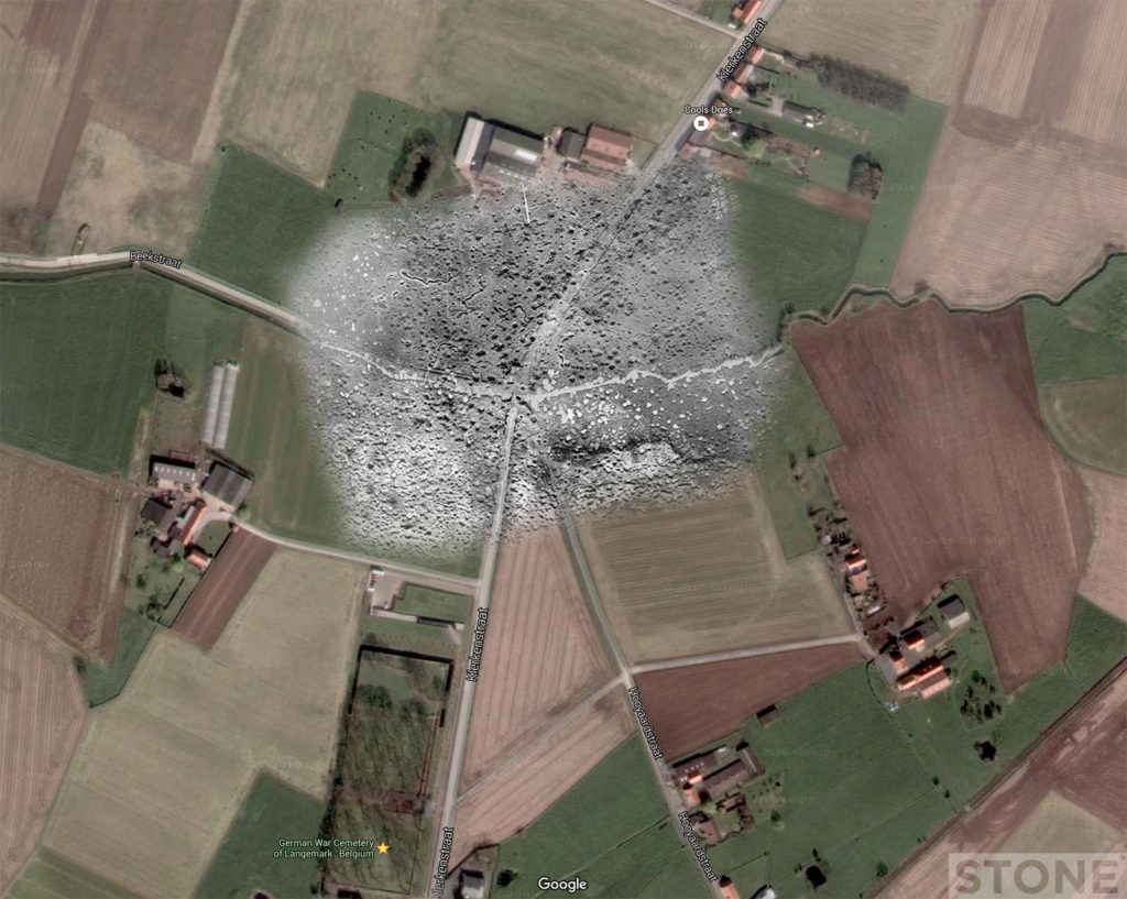
A few trench ghosts I did last week then got distracted and forgot about. One of Langemark and one of the Sugarloaf salient at Fromelles. The Langemark rephoto leaps out straight away. It’s also familiar to anyone that’s ever visited the German cemetery which is just below the crossroads. As with the Messines colourised picture that I ghosted last week the aerial laps almost onto the cemetery. The beck hasn’t moved, it’s an exact fit. The squiggles in the field above are I believe small unlinked German breastworks or dislocated trench systems.
Fromelles
The Fromelles one was distinctly more difficult, due in part to the fact that there’s nothing much to hang on to apart from a tiny sliver of road and a small field with a chunk out of the corner that give it away. So that one involved trench maps too to try and find a field which was a field and still is. The lines were very close together, it makes it slightly surreal. This is the site of the attack of the 19th of July 1916.
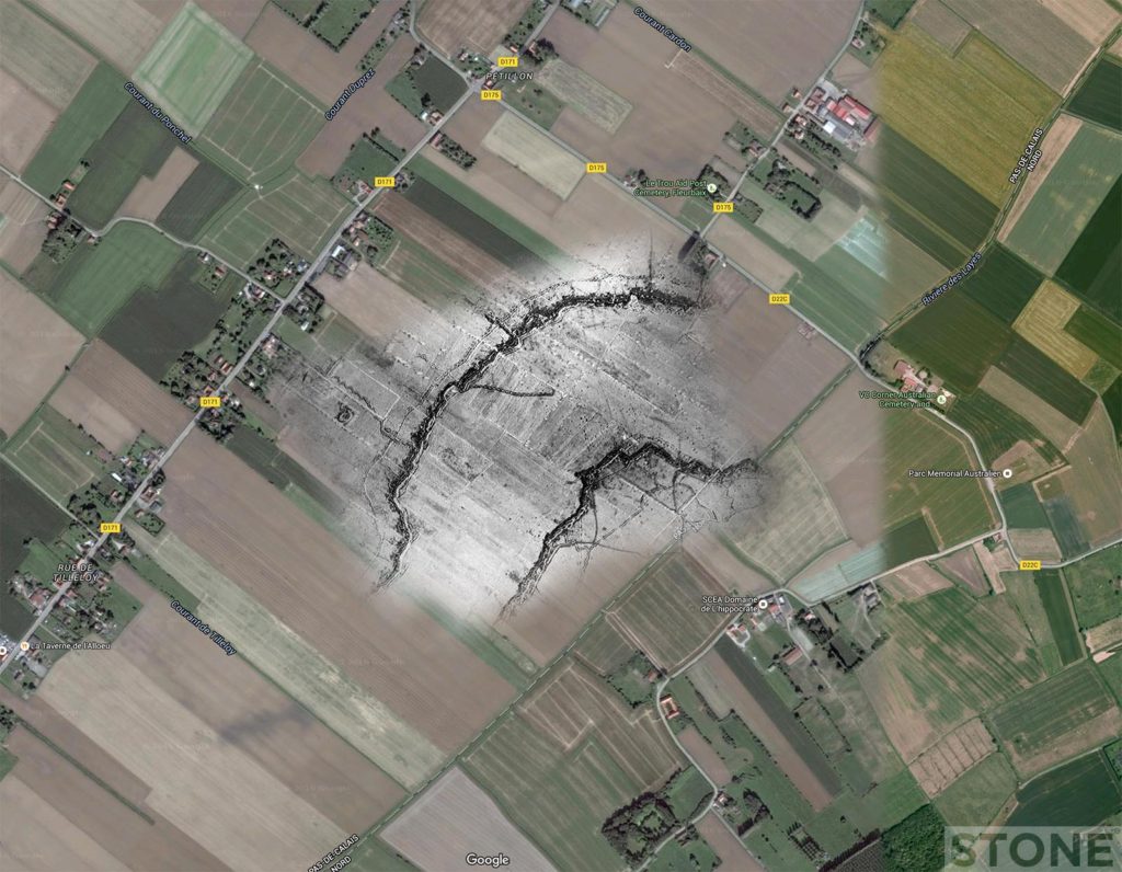
© Nick Stone and source: Googlemaps


These are all really very interesting and helpful when teaching young people about the Great War – they translate onto the ground directly and therefore make it much more real than just a map or a picture. I’d love to see more of these and indeed find out how to do them myself – especially lifting trench traces onto google maps.