
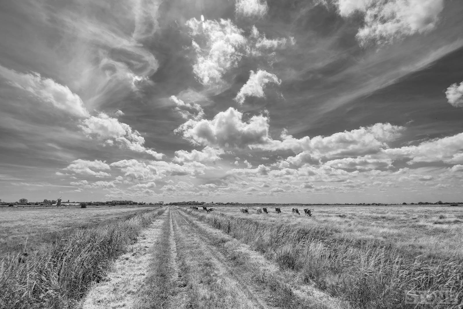
The weather window suddenly being kind, blue skies and a bit of a breeze over the flat lands of Norfolk. Living here, it’s easy to forget how lucky we are, the cliche of our vast skies gets lost as we all head off to places that have those curious walls of land all around them, the Peak District, The North York Moors, Dartmoor, the Chilterns or Wales. One of our group has been living in Eastern Europe for the last eighteen months, having grown up here, was quick to comment on the massive expanse of sky, ‘not penned in, it runs from edge to edge’. Our landscapes are made of various states of water, from the scooped out watery mass of the Broads to the fluid ribbon twists of the Rivers Bure, Ant, Yare and Thurne that feed these largely hand-dug pits before the slow fall-off outward into the sea.
We have or mountains of steam, the clouds that form here, not the grey lid we are so familiar with, but our slow moving peaks, the dark shapes like a distant shore across the North Sea. The other sense you get is how the air works here. Planted in the landscape there are the old windpumps, set to stop the rising water taking the farmland back to the marsh it once itself formed from the slowly silted Romano-British estuary – mirrored by the turbines at Winterton and in the shoals off the coast. You can stand in this land and watch a sail full of air push through the reeds, a ship of the green desert, the water, always there, sometimes lost below your line of sight.
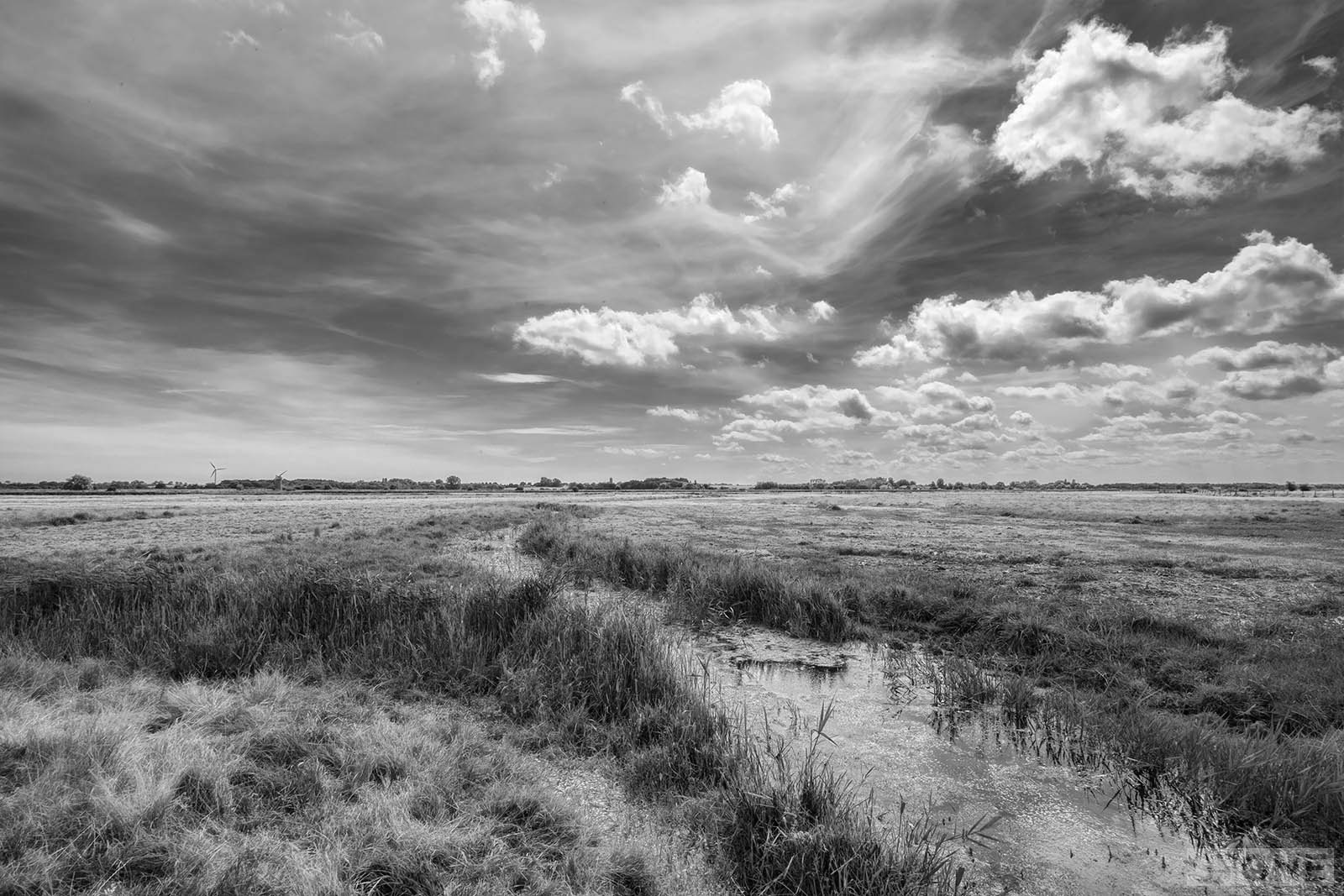
Heigham Holmes opens once a year, for one day, it is ostensibly still a working farm, mostly beef and milk, a clump of building at the centre, grass lapping round them, a pneumatic bridge cuts it off from the surrounding land and the village of Martham and the cut which runs down to it; lined as it is with boats and pleasure craft.
The land is isolated by water, dykes and rivers surround it on every side. It’s isolated enough that it has been said to have been a Secret Operations Executives (SOE) base during the Second World War, this is possibly corroborated by some evidence from local aerial photography, recorded in the Norfolk HER and points at what could be an airstrip and some Nissen huts to the east of the strip. Activity here was also allegedly reported by locals, including stories of strangers drinking in and staying at the local pub. However, all of this is uncorroborated, and the main source of the information is from Norfolk and Suffolk Airfields and Airstrips’ (Part 6), authored by Huby Fairhead and published by the Norfolk & Suffolk Aviation Museum in June 1989, which remains uncorroborated, and beyond that there is almost evidence of anything being here.
What is available makes no mention of any flights; it has been suggested that 161 Squadron, which flew Lysanders – those stalwart short-takeoff and landing flew from here. This is really doubtful and completely uncorroborated as published records in the form of Operations Record Books (ORBs) indicate 161 who flew these operations to the Netherlands mostly did so from RAF Tempsford in Bedfordshire. What is vaguely possible it is that it may have been a dummy airfield, or could have been used occasionally as a landing strip for Coastal Search and Rescue but both those also seem unlikely as again there’s no record, and you have to ask but why? Those flights were usually from either from RAF Matlask or RAF Coltishall.
What seems most likely is that this is all just be received-memory based on, stories about stories, which in turn are unreliable and based on seeing other aircraft in the area used for coastal search and rescue, or aircraft from nearby RAF Ludham in the vicinity. So basically what it was or whether in fact was ever anything at all is a bit of a mystery.
Whatever is the truth, nothing visible remains, and the landscape continues its silent.
Revised Jan 2025
If this is the place i’m thinking of, there was a control tower there when i was a kid, late 60’s to mid 70’s? Somewhere in my mind is a memory of it being a Spitfire base, the Lysander story makes sense though. There were never any signs to it, but i do remember seeing the ferry and I’m sure i sailed past.I thought there was a runway too?
Any old locals got any memories i wonder.
Your tales make me miss Norfolk, i now live in Oz
regards
Andy
Hi Andy. I think you might be thinking of RAF Ludham which isn’t very far away and was a base for both Spitfires, it was a satellite airfield for RAF Coltishall. Some of the buildings are still evident. I believe the control tower was renovated, but has since fallen back into disrepair. Tomorrow’s World presenter Raymond Baxter flew from there during the war. Anything from Ludham would have been grass strip and clandestine, if it in fact was used as a base. I can only find one aerial photo of it from around 1944 that hints at some activity.
Another great article – I have visited Heigham Holmes being interested in wartime Norfolk and believe the SOE site is subject to 100 yes 100! years secrecy rule – what on earth were they doing there, must other site records are now open, although if they were flying into Holland most of the agents were captured on landing sue to the Derricourt and Buckmaster double cross – think it was the Prospero RIng, might be wrong on that. Kirsty
Thanks Kirsty. I believe the Dutch have an even longer embargo on the information than we do.
hi..this was indeed an soe base .there is a ww2 aerial pix clearly marking all .the agents used to stay in the village pub the night before the flights out..usually by lysanders..the sad history of the dutch missions is well documented….vera atkins and buckmaster have a lot to answer for…im sure norfolks archaeological mob did a dig there a few years ago…the farm house and nisson huts are gone tho…shame its only open once a year..which is odd to say the least.
a very sad air hangs over the whole site.
lest we forget
nobby
There was no SOE, or other, airfield at Heigham Holmes. This location was dreamed up to be included in the booklet on Airfields of Norfolk and Suffolk published by the Norfolk and Suffolk Air Museum in the mid-90s. Maurice Buckmaster was not involved in the Dutch SOE, he dealt with the French section and Vera Atkins was his no 2 there.
Nobby, I am interested to learn more about the agents having stayed in the village pub. Would you kindly share your source of information, please? Many thanks.
Heigham Holmes was never used by the SOE. Yes, the SOE as well as the Dutch records are inaccessible but the 138 and 161 Squadrons’ operations record books are public and uncensored, and clearly show that none of the agents parachuted into Holland was transported in a Lysander. The Dutch agents were transported in Whitleys or Halifaxes, none of which were capable of landing on Heigham Holmes, and most of these operations were flown by 138 Squadron. The documents arepublicly available at the National Archives. During the period in question the SOE’s Dutch section was headed by Charles Blizard. The Dutch operations never involved Maurice Buckmaster, who headed the SOE’s French section. A Lysander Flight formed part of 161 Squadron, flying many operations to France, from RAF Tangmere. But not to Holland and certainly not from Heigham Holmes.
I find it fascinating that so many people have such firm belief in their version of the Heigham Holmes story. Older local folk speak of unusual activity on the Holmes, vehicle movements and lights. I cannot refute their accounts nor can I confirm them. The truth will out one day.
you can clearly see the little airfield from the map/pictures here, http://www.historic-maps.norfolk.gov.uk/mapexplorer/