
Ah, now I’ve got you lost too.
And that will be England gone,
The shadows, the meadows, the lanes,
The guildhalls, the carved choirs.
There’ll be books; it will linger on
In galleries; but all that remains
For us will be concrete and tyres.
Try using the search function below to find what you need.
Alternatively you can read some recent pieces by clicking on the stuff below.
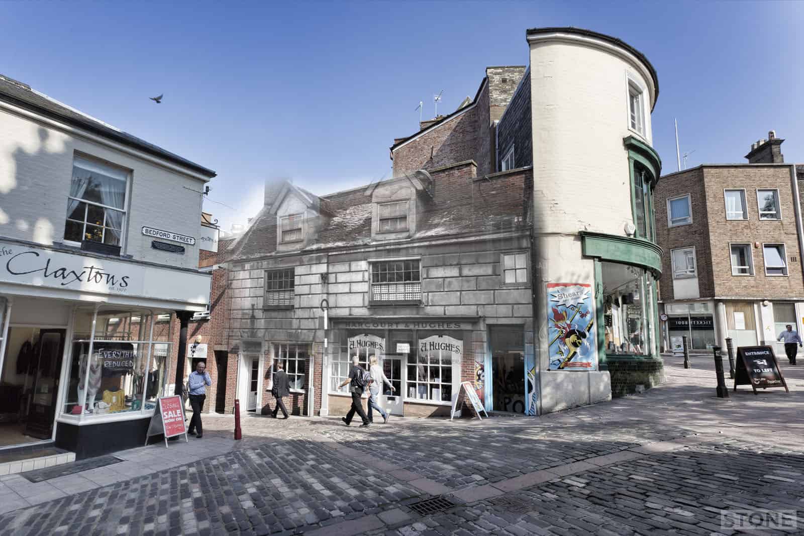
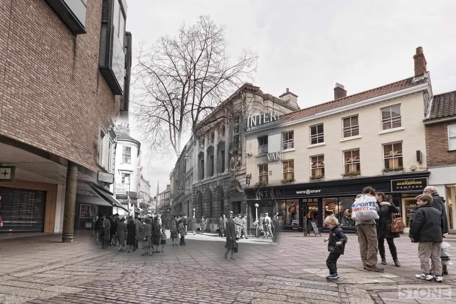
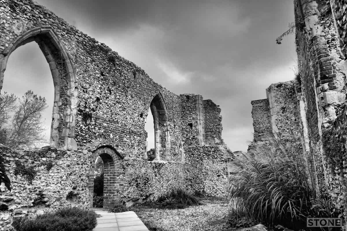
Lost City Ghosts: St Andrews Hill
I went for a wander to do some work stuff and the light was wrong for what I was actually supposed to be doing so on the way back up St Andrew's Hill I did these two. Both are George Plunkett photos from 1936, showing the old buildings at the head of the hill where it...
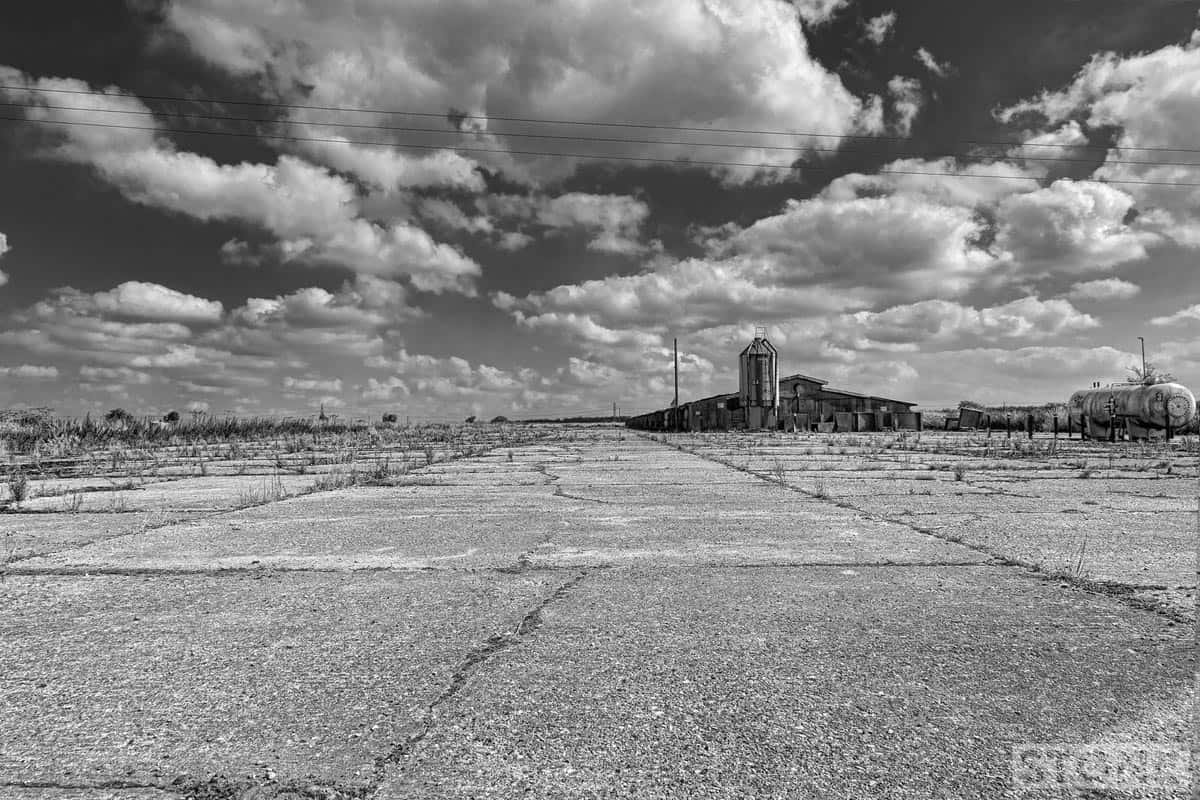
Dead cities: RAF Attlebridge
RAF Attlebridge ...the end of the South Eastern runway, Honingham Road, Western Longville. The most accessible publicly visible bit of the airfield left. The first station built in Norfolk for WW2 use. Originally RAF flying Blenheims and Bostons, it passed to USAAF as...
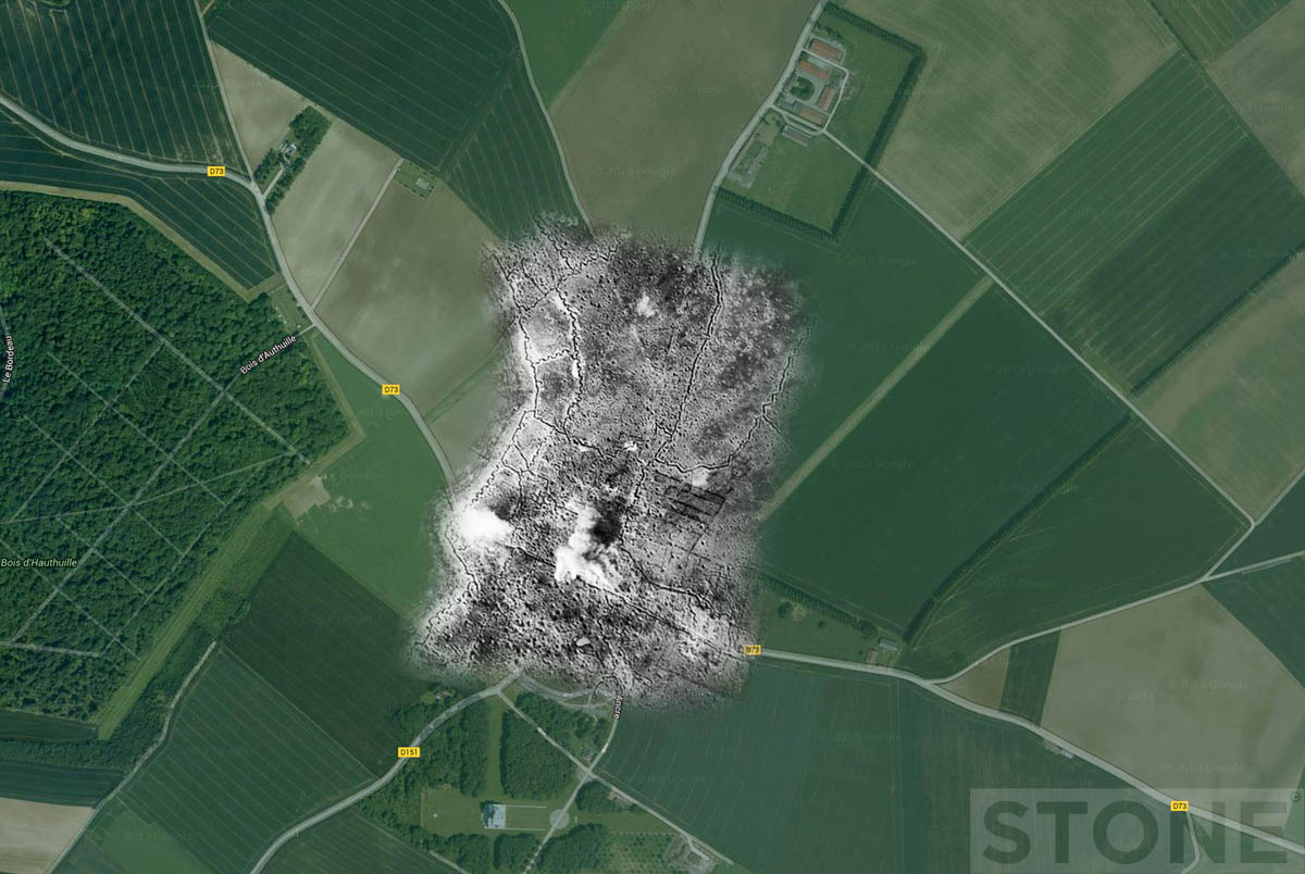
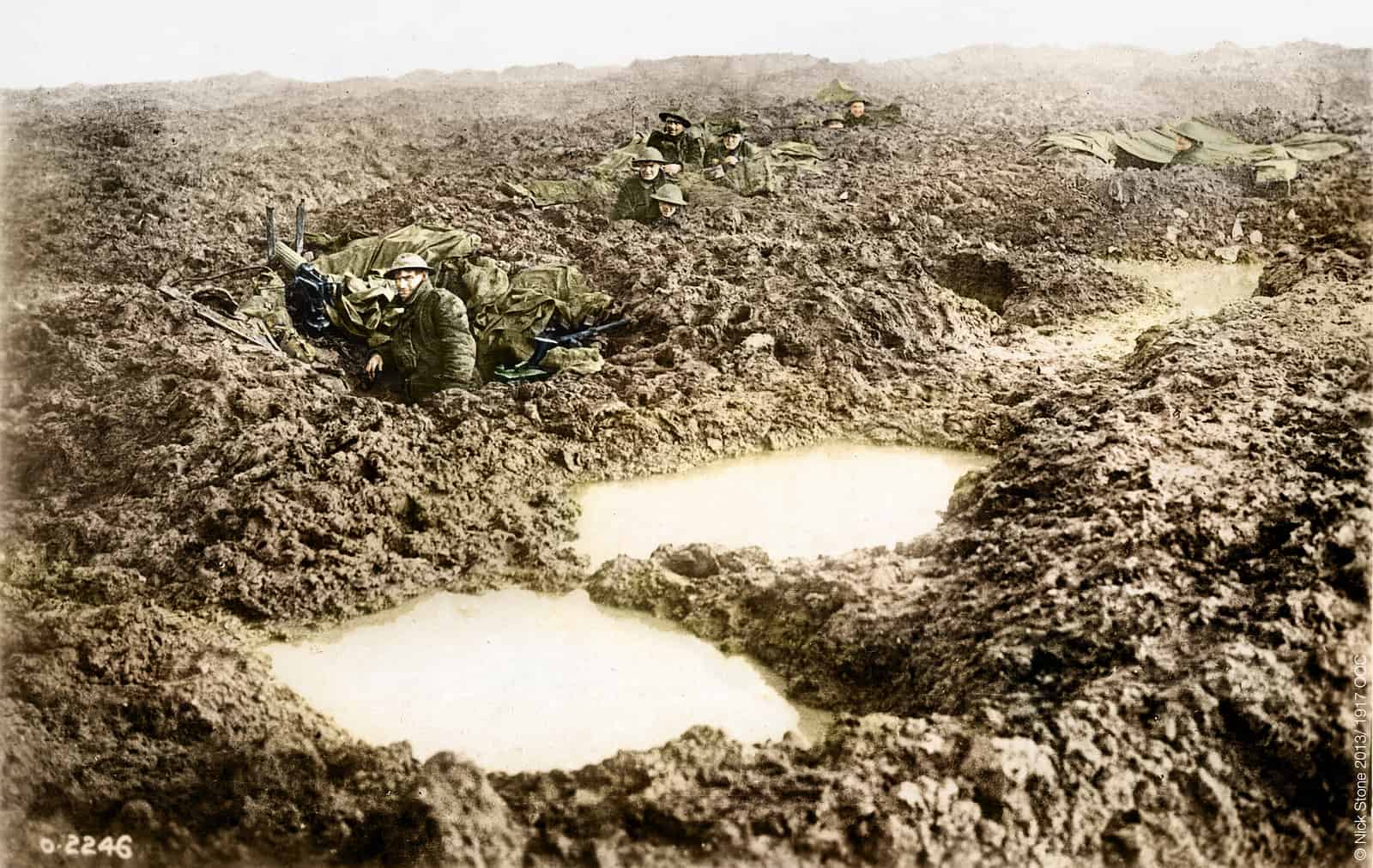
WW1: Aerial Trench Ghosts Part 1
I did one of these to explain something to someone, then tweeted it and it all went a bit nuts, so it makes sense to put some of them together into posts on here rather than having them scattered to the 00000100 corners of the digital world. Schwaben Redoubt Early...
Ghost Airfields of WW2: Part 2
Second in the series, again a simple trick, sticking an aerial photo on a Google map, Maps eh, what's not to like. A selection here from the fair scatter across Norfolk, more to follow eventually. The Ghost above is from a series of photos which were pointed out to me...
Ghost Airfields of WW2: Part 1
I did these a few years ago, basically sticking aerial photos onto Google maps, I'd pretty much forgotten them until earlier. They seem worthy of a few posts. There are hundreds of these sites in East Anglia, and all, where accessible are worth a visit. If you want to...
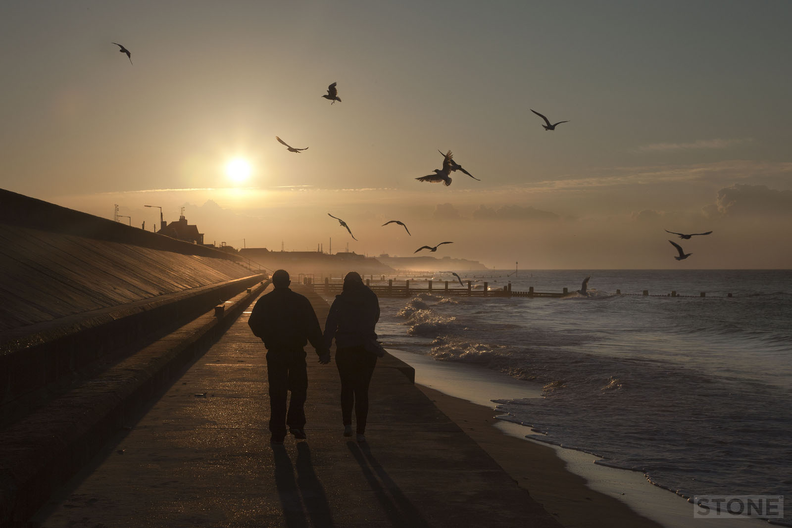
Coasting: Walcott
We used to go to Walcott and Bacton quite a lot when I was a kid, it's was and is all concrete, groynes and flat inland space, with the rising glacial moraines starting just to the North towards Trimingham. You can see the past up on the cliffs to the North the rise...
Colourising: The Great War
A couple of years ago I did a series of these, mainly individual soldiers from my private collection of postcards, I also did a few of these, now ubiquitously crayoned in, see 'em everywhere type images, so I thought I might as well add my favourites to the website...
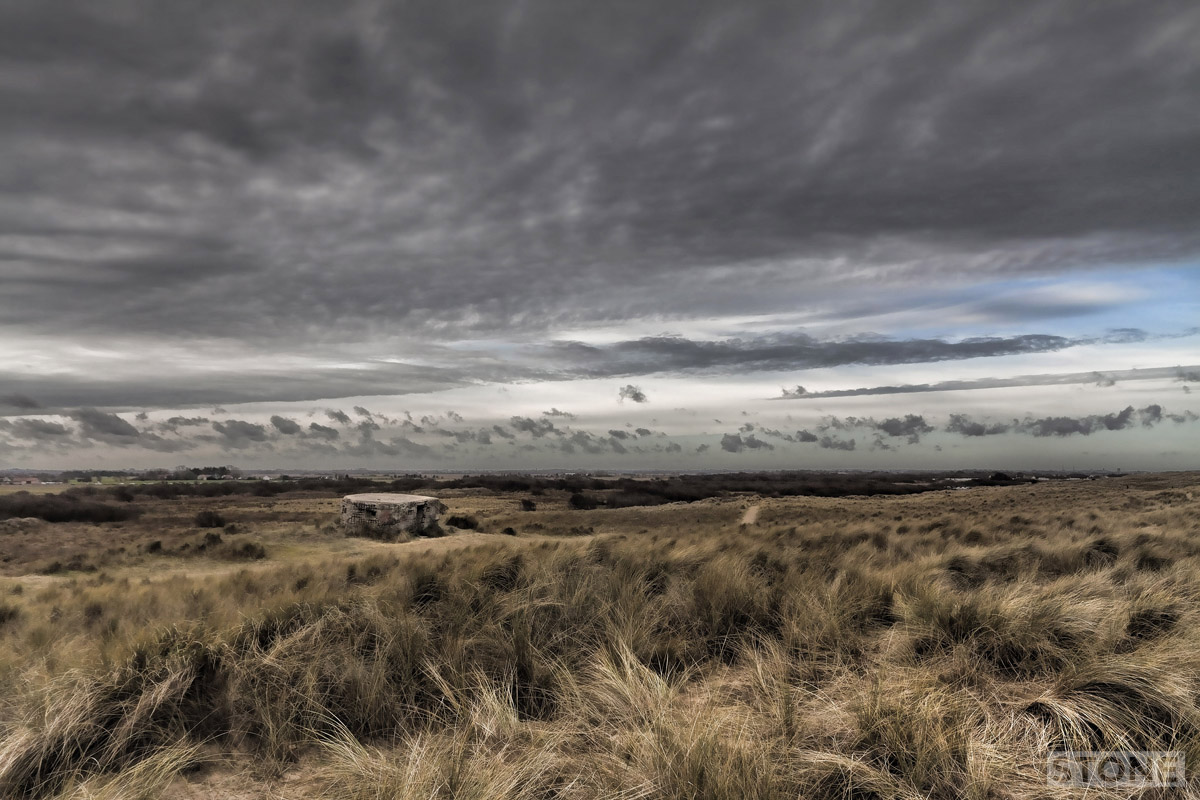
Coasting: Horsey
Horsey is a curious area, it's always felt like slightly dead ground to me, for the uninitiated it is just to the North of Winterton and South of Waxham, it has it's own Broad a large flat expanse of water edged by windpumps, dunes and intermittent seals. One of my...
Lost in a landscape: Bowthorpe DMV
We live in Bowthorpe for about three months, it wasn't my cup of tea, I've never quite got my head around modern houses, preferring to live in a series of brick built Victorian freezers with leaky roofs and nowhere to park, I'm clever like that. One of the...
Lost in a Landscape: Little Hautbois
Another desertion. The photograph below was taken looking very roughly South at the present day situation of Little Hautbois; Little more than a row of houses just off the B1150, set in Pretty Farmland, it still just about clings on to its existence. As you follow the...
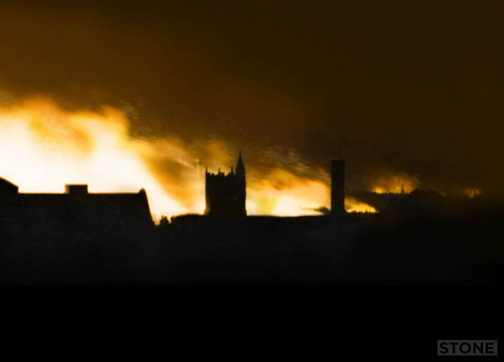
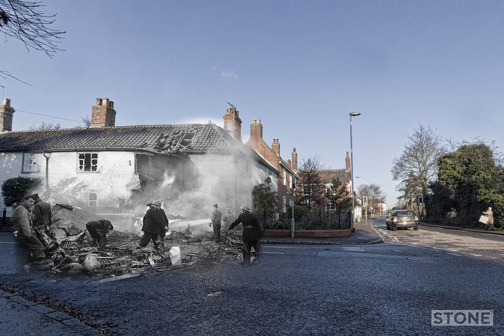
Norwich in flames
Norwich in Flames: Here are a selection of George Swain's camera melting exploits. Originally photographed in Black and White. I colourised these, based on looking at modern colour photos of fires and then painting them in, very simply to be honest. They depict the...
Vanishing point: Berlin Sap
It looks like a field, because it is a field, one that slopes gently up to a low ridge, 60 metres at its highest point, best appreciated either from a mile or so back in the open areas behind the old line. It looks like nothing much, close up it is just a slope and...