

Lost in a landscape: Worstead
I was looking for something else, I didn’t actually find what I was after, because of gates and no access signs and the sound of people murdering wildlife in Westwick woods, but as I pootled down another dead end this vista was there, so I hopped along...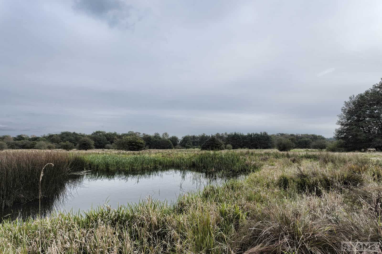
Lost in a landscape: Thompson – Below the glacier.
When I was at school we had a teacher called Peter ‘Percy’ Williams, he primarily taught geography. At first he hammered it into our small and stupid heads; over those first three years he gradually worked out which ones of us were holding the water and...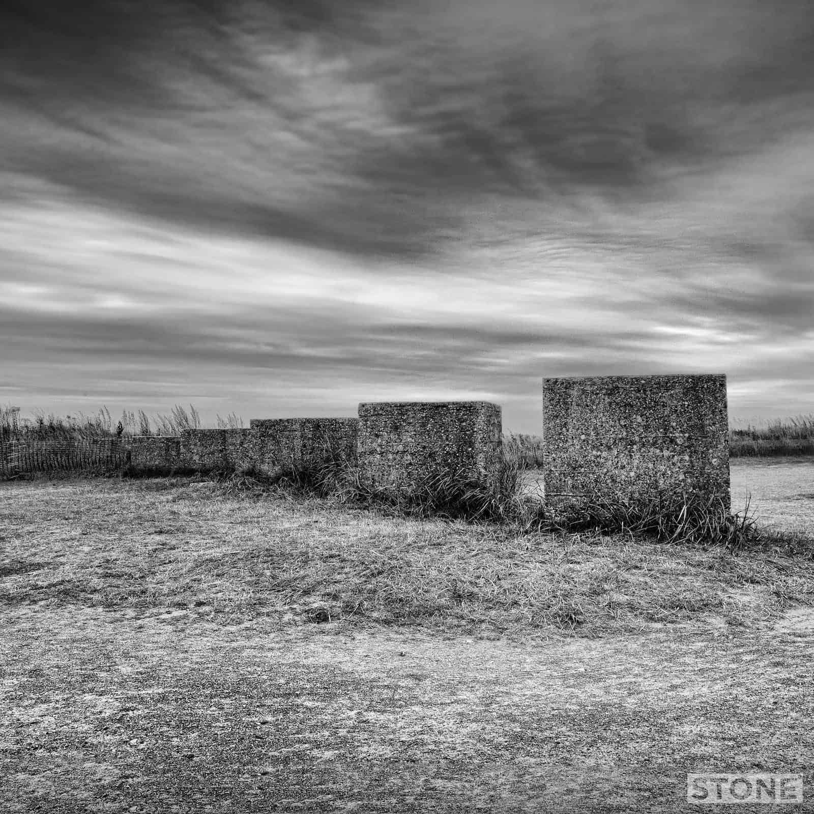
Coasting: Winterton
Yet more lumps of concrete, I doubt a the vast majority of people even give them a thought apart from trying not to scratch the car. Bit strange though, 13 ton blocks of concrete in a car park, and on the beach in one of those lovely little Norfolk corners. Winterton,...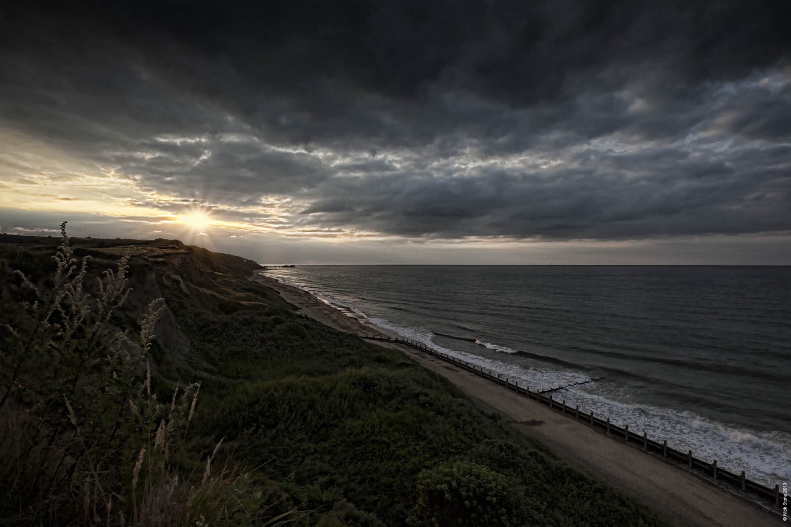
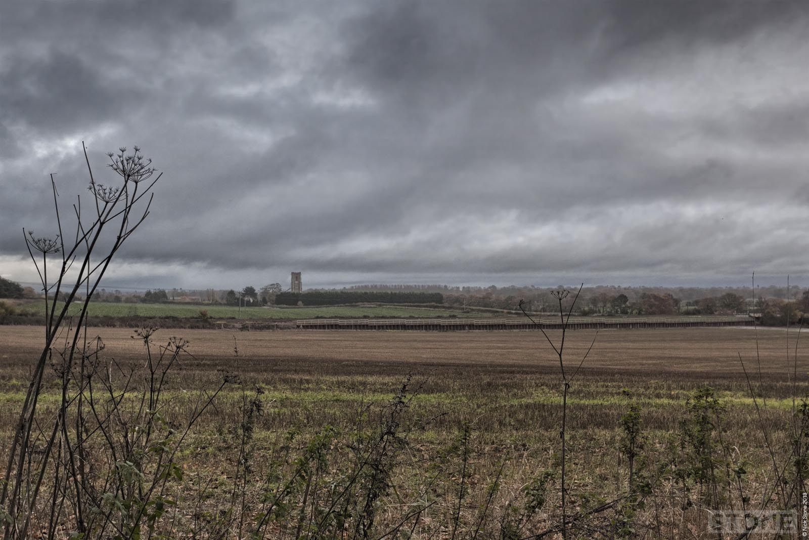
Lost in a Landscape: Shipden
We are spoilt for lost villages in Norfolk and due to the nature of the coast have a huge number that weren’t down to the usual suspects, so not things like plague, pestilence or bad land for farming or landlords enclosing land or commons; moving sheep in to...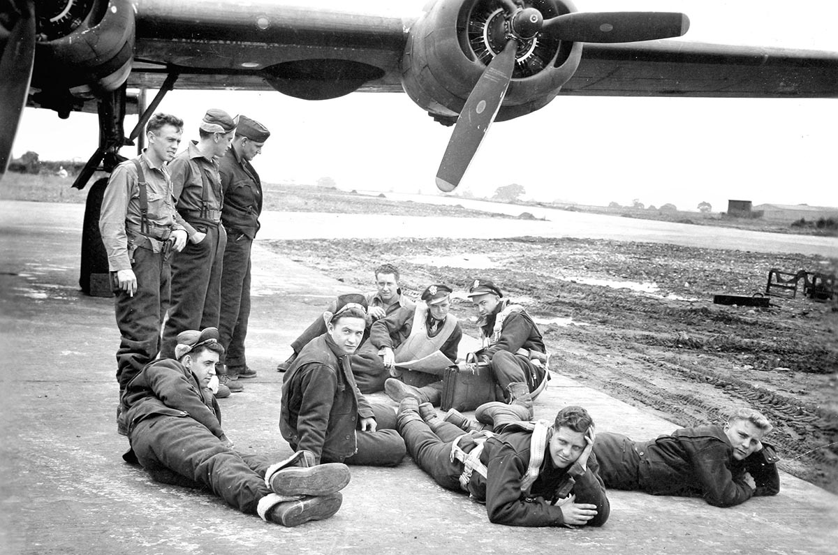
WW2 RAF and USAAF airfields in Norfolk mapped
Several years ago, I did this entirely to satisfy my own wanderings around WW2 RAF and USAAF airfields in Norfolk. It’s publicly visible on Google already, but it made sense to post it on the website to so it’s more findable. It is worth noting that a lot...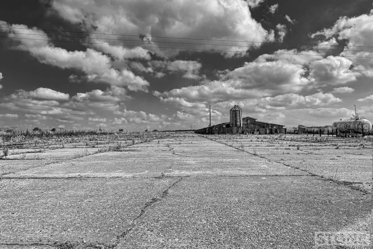
Dead cities: RAF Attlebridge
RAF Attlebridge …the end of the South Eastern runway, Honingham Road, Western Longville. The most accessible publicly visible bit of the airfield left. The first station built in Norfolk for WW2 use. Originally RAF flying Blenheims and Bostons, it passed to...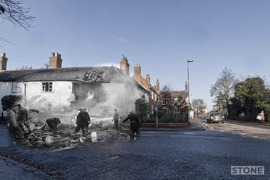
Ghost Airfields of WW2: Part 1
I did these a few years ago, basically sticking aerial photos onto Google maps, I’d pretty much forgotten them until earlier. They seem worthy of a few posts. There are hundreds of these sites in East Anglia, and all, where accessible are worth a visit. If you...
Coasting: Walcott
We used to go to Walcott and Bacton quite a lot when I was a kid, it’s was and is all concrete, groynes and flat inland space, with the rising glacial moraines starting just to the North towards Trimingham. You can see the past up on the cliffs to the North the...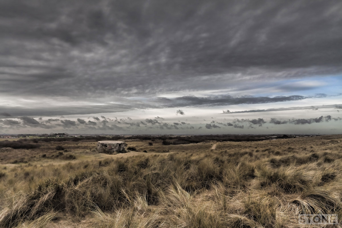
Coasting: Horsey
Horsey is a curious area, it’s always felt like slightly dead ground to me, for the uninitiated it is just to the North of Winterton and South of Waxham, it has it’s own Broad a large flat expanse of water edged by windpumps, dunes and intermittent seals....
Lost in a Landscape: Little Hautbois
Another desertion. The photograph below was taken looking very roughly South at the present day situation of Little Hautbois; Little more than a row of houses just off the B1150, set in Pretty Farmland, it still just about clings on to its existence. As you follow the...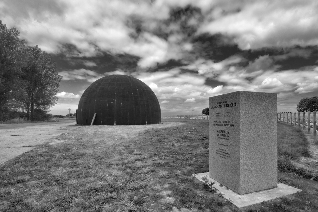
Dead cities: Langham Dome
Langham Dome A sort of anti-axis forces death star type thing. It looks a bit like one of those chocolate bombs or a steamed pudding, but about 18 feet high, made of reinforced concrete and painted black. Nestling on the edge of an abandoned airfield about 4 miles...Products
-
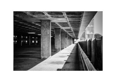
 Light well
£12.00
Light well
£12.00
-
 Vanishing point
£12.00
Vanishing point
£12.00
-
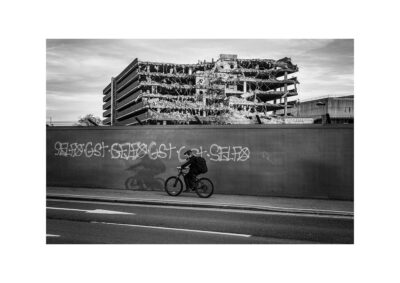 Passing
£12.00
Passing
£12.00
-
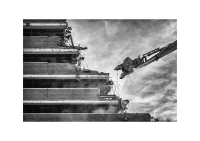 Bite
£12.00
Bite
£12.00
-
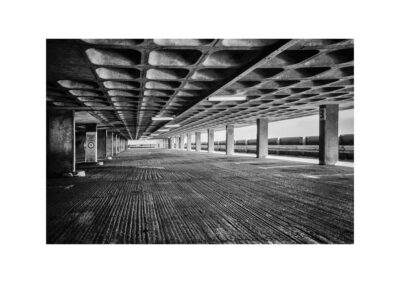 Concrete
£12.00
Concrete
£12.00